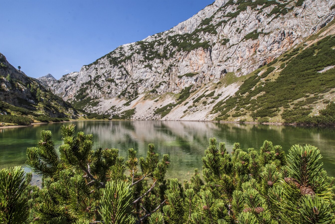
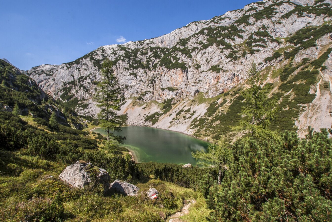
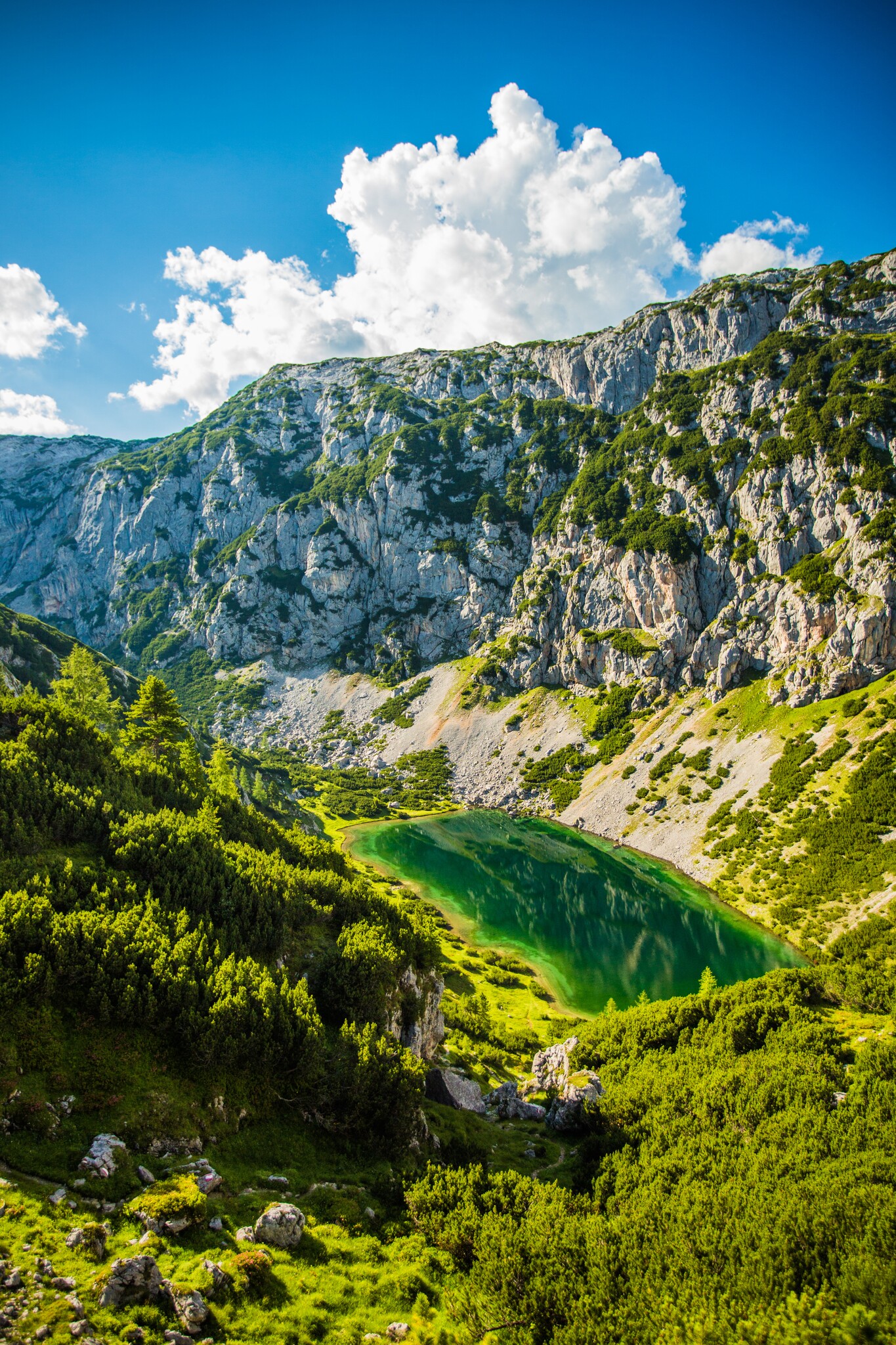
Silberkar Lake - a hidden treasure

Tour description
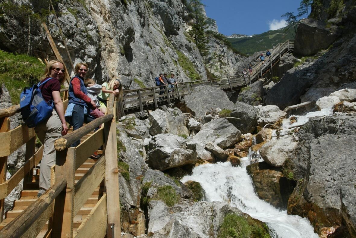
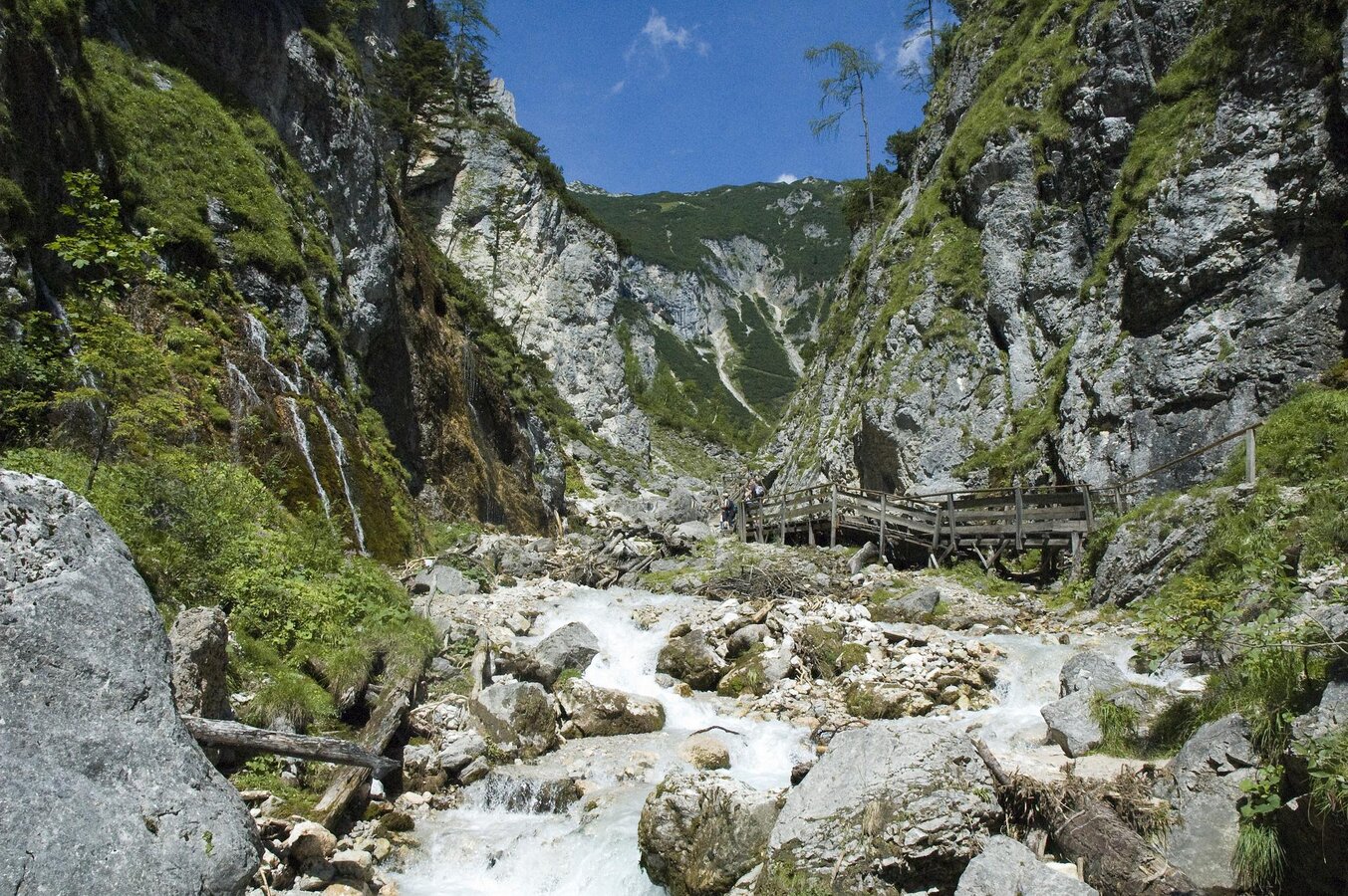
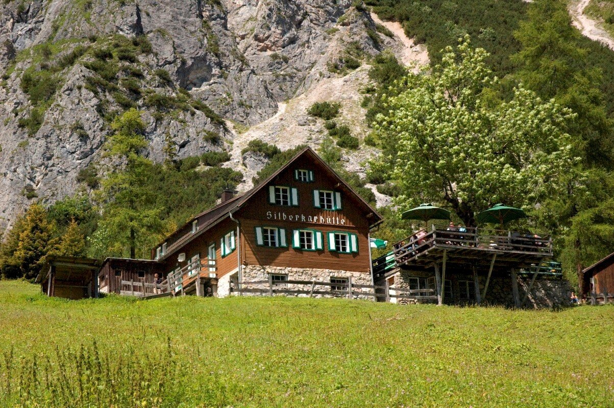
The tour
Map, elevation profile & further information
The return journey follows the same route. An alternative route to the valley is to take hiking trail #66 through the Seetal valley up to trail #616 and then along this to the Guttenberghaus, and from there back to Ramsau am Dachstein.
From west: Tauernautobahn A 10 to the Ennstal junction - exit in the direction of Graz/Schladming - around 20 km on the Ennstal federal road to Schladming - Ramsau junction. In Ramsau to the "Stierer-Kreisung" where you turn towards Rössing. Downhill to Rössing and left at the Lodenwalker up to the Silberkarklamm car park.
From North/East: Pyhrn autobahn in the direction of Liezen and Ennstal federal road to Aich. At Höhenfeld, turn off in the direction of Ramsau am Dachstein. Through Weißenbach near Haus and along the state road to Ramsau Rössing. Turn right at the Lodenwalker and up to the Silberkarklamm car park.
Silberkarklamm car park. Attention: partly subject to a fee!With the regular buses of the Ramsauer Verkehrsbetriebe (route # 962) to the Silberkarklamm stop in Ramsau Rössing.
Schedula available at: www.rvb.at
Sudden changes in the weather, rapid drops in temperature, thunderstorms, wind, fog, and snowfields are objective hazards and require proper behavior while out and about. Hut keepers are experienced mountaineers and can provide good tips on the weather and the route. Inadequate equipment, overconfidence, carelessness, poor physical condition, and incorrect assessment can lead to critical situations. During thunderstorms: Avoid summits, ridges, and rope safety devices at all costs.
GPS data and orientation aids
Available GPS data—like hiking maps—are only a guide, as they can never accurately depict or represent the richness of detail of a real trail. Especially in dangerous areas, the decision as to whether and how to proceed must always be based on the local conditions.
In case of emergency, please call the following emergency numbers:
- 140 - for alpine emergencies - Austria-wide
- 112 - Euro emergency number GSM emergency service


