contact
contact
ForYou Club
1 / 76 lifts
0 / 152 slopes
2 / 39 XC-Trails
8 °C
Webcam
Current info
back
Haus-Aich

From Stoderzinken to the Viehbergalm

Tour description

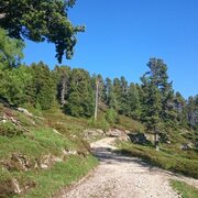
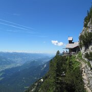
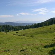
From Gasthof Steiner on the Stoderzinken, we follow the dirt road to the Brünnerhütte.  A beautiful larch forest interspersed with pine surrounds narrow path No. 618, which we follow for the better part of an hour through the Brandner Urwald.  In the valley bottom below the Kimpflingsattel, we branch off to the Notgasse. We need to pay close attention, since the markings are easy to miss.  Big clearings, such as the Wiesmahd, occasionally interrupt the dense forest.  It was here, in former times, that charcoal was produced.  In the narrow, some 550 m long and up to 30 m wide rocky canyon of the Notgasse, it is not rare for snow to be on the ground until well into summer.   Because of the rock drawings discovered there, the Notgasse is protected as an important cultural site – so please take that into consideration!  After this ancient trade route, we come to a new forestry lane, which we follow to the Brandalm – from there now along the Bettlersteig trail to a beautiful hut village at the Viehbergalm. Following trail No. 28, we descend about 300 m as far as the Rahnstube, where we again meet up with that forestry lane from the Brandalm.  We continue through flat terrain until a beautiful path through the impressive Öfen brings us to Gröbming Winkl.

The tour

moderate
Starting point P on the Stoderzinken – end of the Stoderzinken Alpine Road, elev. 1,890 m
Destination Gröbming Winkl
Tour characteristics
Fitness (4/6)
Skills (3/6)
Information
Distance: 18.6 km
Duration: 6 h
Ascent: 360 m
Descent: 1210 m
highest point: 1829 m
Best season
Jan
Feb
Mar
Apr
May
Jun
Jul
Aug
Sep
Oct
Nov
Dec

Map, elevation profile & further information

From Gasthof Steiner on the Stoderzinken, we follow the dirt road to the Brünnerhütte.  A beautiful larch forest interspersed with pine surrounds narrow path No. 618, which we follow for the better part of an hour through the Brandner Urwald.  In the valley bottom below the Kimpflingsattel, we branch off to the Notgasse. We need to pay close attention, since the markings are easy to miss.  Big clearings, such as the Wiesmahd, occasionally interrupt the dense forest.  It was here, in former times, that charcoal was produced.  In the narrow, some 550 m long and up to 30 m wide rocky canyon of the Notgasse, it is not rare for snow to be on the ground until well into summer.   Because of the rock drawings discovered there, the Notgasse is protected as an important cultural site – so please take that into consideration!  After this ancient trade route, we come to a new forestry lane, which we follow to the Brandalm – from there now along the Bettlersteig trail to a beautiful hut village at the Viehbergalm.Following trail No. 28, we descend about 300 m as far as the Rahnstube, where we again meet up with that forestry lane from the Brandalm.  We continue through flat terrain until a beautiful path through the impressive Öfen brings us to Gröbming Winkl.

If you took the shuttle bus to the Stoderzinken, you can hike up to the adventure park near the Gröbminger Alm and then take the bus back to Gröbming.
In Gröbming, take the B320 Ennstal federal highway and follow Stoderstraße out of town. From the Gröbming Adventure Park onwards, Stoderstraße is a toll road.

Parking area at the end of the Stoderzinken Alpenstraße
During the summer holidays, a shuttle bus runs between Gröbming and Stoderzinken.

Hiking taxi Sport Kornberger, minimum of 4 people. Register by phone; Tel.: 03685/22172
Sturdy shoes, rain gear
Interesting guides of experts through the Notgasse! Further information at the tourist office Gröbminger Land, Tel. 03685/22131 22. Hiking tours every Thursday from end of May until mid-October (dependent on weather conditions)

Safety information

Safety on the mountainside: changes in the weather, sudden fall in temperature, thunder storms, wind, fog and snow fields are all objective dangers and require the correct behaviour whilst underway. the landlords of the huts are all very knowledgeable about the mountains and can give you good tips about the weather and the routes. Insufficient equipment, exaggerated opinion of ones capabilities, frivolousness, poor health condition and a false evaluation of the situation can lead to a critical situation. In thunder storms: summits, crest-sites and safety rope aids are to be avoided.

If something should happen call following emergency numbers: No. 140 - the number for all Alpine Emergencies in all of Austria No. 112 - European emergency call GSM emergency-call-service

Wheather predicition

today
07.11.2025
Mountain 11 °C
Valley 10 °C
Precipitation
Probability
0 %
Amount
0 l/m²
Wind speed
Sued
5 km / h
Sun
Sun hours
9.7 h
Sunrise
06:58 o clock
Sunset
16:39 o clock

Dry and sunny throughout the day with hardly any clouds.

tomorrow
08.11.2025
Mountain 6 °C
Valley 8 °C
Precipitation
Probability
5 %
Amount
0 l/m²
Wind speed
Nordwest
5 km / h
Sun
Sun hours
9.2 h
Sunrise
06:59 o clock
Sunset
16:37 o clock

Dry and sunny throughout the day with hardly any clouds.

day after tomorrow
09.11.2025
Mountain 2 °C
Valley 8 °C
Precipitation
Probability
15 %
Amount
0.4 l/m²
Wind speed
West
10 km / h
Sun
Sun hours
1.9 h
Sunrise
07:01 o clock
Sunset
16:36 o clock

Partly sunny in the morning, gradually becoming cloudy in the afternoon.

Tours nearby