Beautiful Hill-Country Hike to Englitztal Valley
Tour description
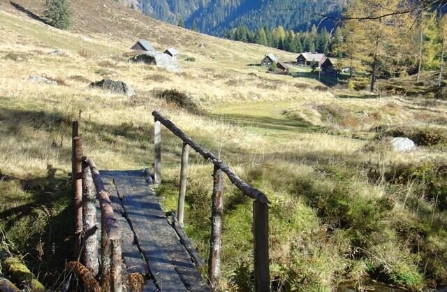
The road to the Upper Walchental is interesting, narrow and flanked by steep forested mountainsides on both sides of the stream, leading us to the former “In der Walchen” mining area and to two high valleys. Shortly after Gasthof Bergkreuz, ouor driving will be done. This is also the location of the Öblarn Copper Path, always interesting, especially when led by a local guide. Heading for the Englitztalalm: At the trail crossing, we turn right off the forestry road, hiking over a small bridge and then along a narrow forest path up to a broader pathway. Climbing moderately, this path takes us past the White Wall (former marble mine) and up a series of switchbacks, until we surprisingly find the flat alpine pastures of Englitztal Valley before us. A small stream, high pastures and the occasional ancient larch tree form the scenery on this valley bottom elev. 1,328 m, surrounded by steep forested mountainsides, while in the north, what is essentially the valley head, we see the striking figure of Hangofen summit. Just a little later and we reach the welcoming Englitztalhütte (crossing the bridge to the left will take us to Ramertal Valley). For families with kids there is a natural playground with a small stream, though this high valley is also perfectly suited for a pleasant walk along a flat pathway.
The tour
Map, elevation profile & further information
Safety information Safety on the mountainside: changes in the weather, sudden fall in temperature, thunder storms, wind, fog and snow fields are all objective dangers and require the correct behaviour whilst underway. The landlords of the huts are all very knowledgeable about the mountains and can give you good tips about the weather and the routes. Insufficient equipment, exaggerated opinion of ones capabilities, frivolousness, poor health condition and a false evaluation of the situation can lead to a critical situation. In thunder storms: summits, crest-sites and safety rope aids are to be avoided.
If something should happen call following emergency numbers:No. 140 - the number for all Alpine Emergencies in all of AustriaNo. 112 - European emergency call GSM emergency-call-service


