Ski tour to the Hochmölbing
Tour description
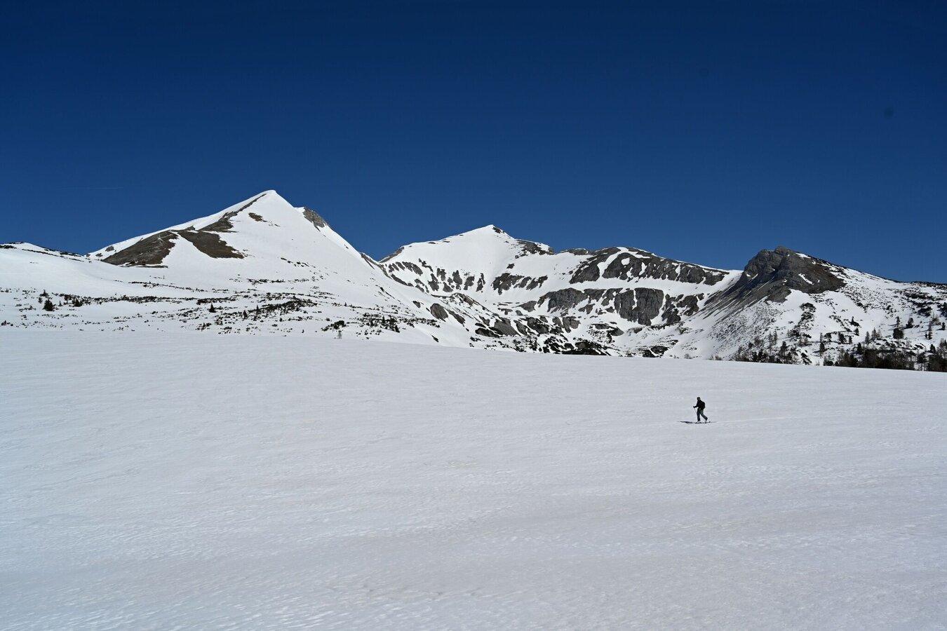
Experience, sense of direction and endurance are a must on this wonderful tour via Hochtor, Liezener Hütte and Mittermölbing. With enough snow and puff it goes up to the Hochmölbing.
The tour
Map, elevation profile & further information
Starting from the parking lot Oberkogler Alm you walk along the forest road to Schönmoos. From there the tour continues through the forest in the direction of Langpoltenalm, past the rugged walls of the Hochtausing. At the Langpoltenalm (see signpost) you branch off to the right in the direction of Hochtor. A steep ascent to the Liezener Hütte follows. Keeping to the right, continue towards Brunnalm and then along the flat ridge towards Querlstein and over Speikboden along the steep ridge to Mittermölbing (ski depot). You then walk for about 15 min along the flat ridge to the summit of Hochmölbing.
Descent as ascent. If the snow and avalanche situation permit, you can enjoy a steep descent through the Mölbing gully down into the Mölbingkar and continue along the valley floor to the Liezener Hütte, where you return to the ascent route.
Leave the Ennstal federal road (B320) in Wörschach. In the village, turn off in the direction of Wörschachberg and drive up to the Oberkogler Alm.
Free parking at the Oberkogler Alm.
Arrival by public transport is only possible as far as Wörschach Ort. Unfortunately there is no bus service up the Wörschachberg.
Mountain sports and the assessment of the situation on site are - even more so in winter - primarily subject to personal responsibility. Tourism associations or avalanche warning services do not assume any liability based on the information provided.
- Check the weather and avalanche situation at www.lawine-steiermark.at before each ski tour.
- The use of the tour description is at your own risk and responsibility.
- Do not go on a ski tour alone. It's more fun together anyway!
- Always behave risk-conscious and react to danger signs!
- Respect existing regulations, such as hunting and game protection areas, reforestation or young growth areas.
- You should always have your cell phone well charged. Do you have the emergency numbers saved? Mountain rescue: 140. If you have no reception, take out the sim card and dial 112.
- Avalanche beacon, probe and shovel are essential in open terrain for this tour glacier equpiment is recommended.
- Ski touring equipment consisting of skis/splitboard, skins, poles and possibly crampons.
- Food, warm drinks, spare clothing and a first aid kit.
- Choose your clothing according to the onion layer principle.
- Maps and/or tour descriptions. GPX tracks on your mobile phone or GPS device are also helpful.
- Ski touring and safety equipment can be rented at Sport Scherz and Sport Schöttl.
The best connoisseur of this area is mountain & ski guide Toni Kerschbaumer from Wörschach. Phone +43 664/4219208
Tourism information: www.schladming-dachstein.at
Tourism blog: www.derbergdastal.at
Tourist Office Schladming-Dachstein
Ramsauerstrasse 756
8970 Schladming
T: +43 3687 23310
Garbage on meadows and paths can not smell mountain and valley. Please take it with you. Agriculture and forestry are important partners for Berg und Tal. They allow you to walk and drive on many of their paths. Be aware that only good cooperation will guarantee your recreational enjoyment in the future.
Sport ScherzAt Riesneralm, Planneralm and in Wörschach+43 (0)3682 22383sport-scherz.at
Sport SchöttlAt Planneralm and in Irdning+43 (0)3682 22952 0sport.schoettl.at
Skitouring Folder available in every Information office.
KOMPASS Map 68, Ausseerland-Ennstal 1:50.000, Hiking, Biking, Ski tours


