Small Gate-Tour

Tour description
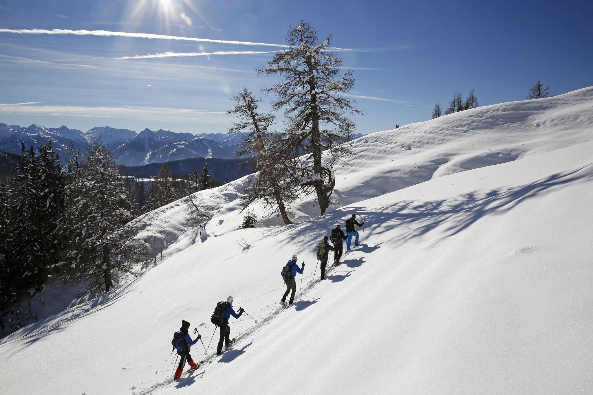
The tour
Map, elevation profile & further information
The starting point for this short gateway tour is the car park at the Dachstein Gletscherbahn valley station at an altitude of approx. 1,700 metres. From here, head east for about one kilometre to the start of the Edelgrieß.
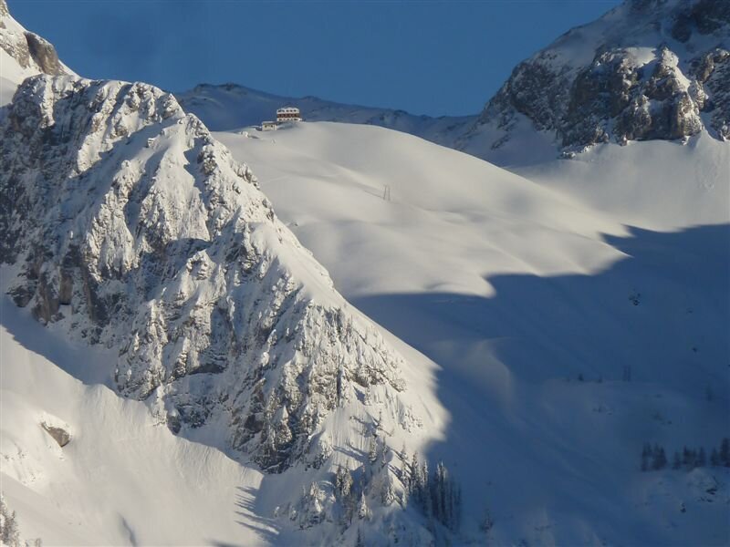
Turn north-east and climb up to the Edelgrieß. After one kilometre you reach the steep step. Caution: crampons + ice axe may be necessary here. At kilometre three, you are now at the highest point of the tour (2,527 m). From here, the route continues steadily downhill along hiking trail 618, past the Gruberscharte ridge, with the Guttenberghaus on the left. The last kilometre you cycle or walk downhill along a forest road and finally you have reached the end point of the route - the Feisterer car park.
If snow conditions are good, you can take the winter hiking trail feeder west from the parking lot – at an appropriate pace – and then descend to the Marharter-Hof. From there, it's a good 400 meters to the Stierer bus stop. From there, take bus number 960 to the final stop at the Dachstein Glacier Cable Car valley station. Alternatively, take the access road back down to the main road and follow it west to the stop (approximately a 25-minute walk).
You can, of course, also drive to the Glacier Cable Car valley station – the road there is a toll road. From the end of your tour, you'll also take the bus back to your car. The routes to the stops remain the same, of course.Parking at the destination point at the Feisterer hiking portal (daily fee) or at the valley station of the Gletscherbahn (toll road).
To reach the starting point take bus number 960 from Schladming train station to the final stop, "Dachstein Türlwandhütte/Gletscherbahn."
From your finishing point at the Feisterer destination, if snow conditions are good, you can take the winter hiking trail feeder west and then descend to the Marharter-Hof at a suitable pace. From there, it's a good 400 meters to the Stierer bus stop. From there, take bus number 960 back to Schladming. Alternatively, you can take the access road back down to the main road and follow it west to the stop (approximately 25 minutes on foot).
- Bus schedule of the Ramsauer Verkehrsbetriebe: www.rvb.at
- Trip Planner: www.verbundlinie.at
Mountain sports and the assessment of the situation on site is your own responsibility. Tourism organisations or avalanche warning services do not accept any liability based on the information provided.
- Check the weather and avalanche situation the evening before every ski tour at, avalanche mobile phone: +43 664 8105928
- Don't go on a ski tour alone. It's more fun together anyway!
- Always behave in a risk-aware manner and react to danger signs!
- Observe existing regulations, e.g. hunting and wildlife protection areas, reforestation or young growth areas.
- You should always have a fully charged mobile phone with you. Have you also saved the emergency numbers? Mountain rescue: 140. If you have no signal, take out the SIM card and dial 112.
- Avalanche beacon, probe and shovel are essential in open terrain for this tour glacier equpiment is recommended.
- Ski touring equipment consisting of skis/splitboard, skins, poles and possibly crampons.
- Food, warm drinks, spare clothing and a first aid kit.
- Choose your clothing according to the onion layer principle.
- Maps and/or tour descriptions. GPX tracks on your mobile phone or GPS device are also helpful.
- Rental possibility for touring skis and safety equipment at Ski Willy.


