Hike to the Hansenalm

Tour description
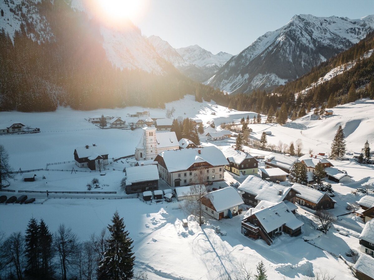
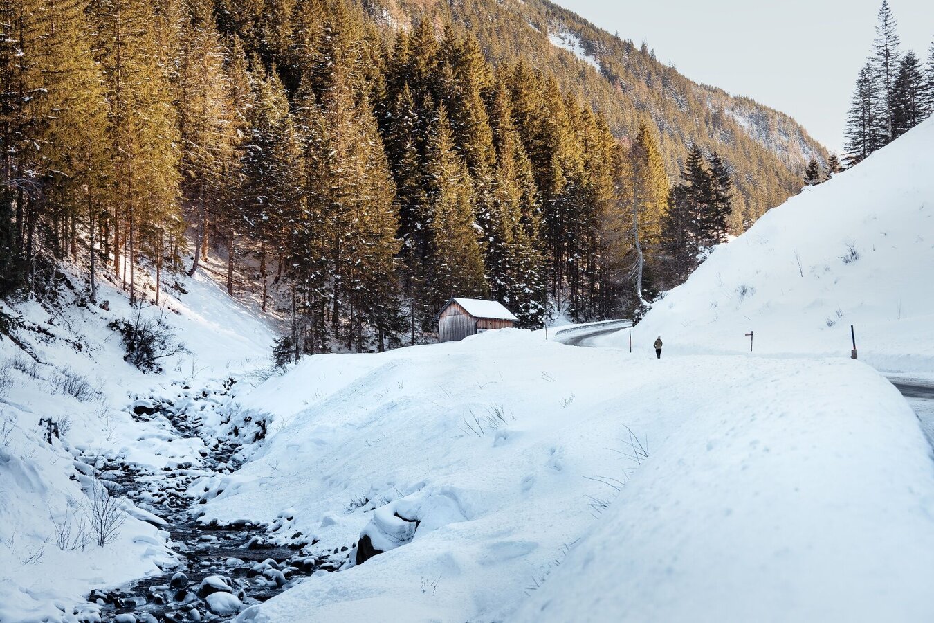
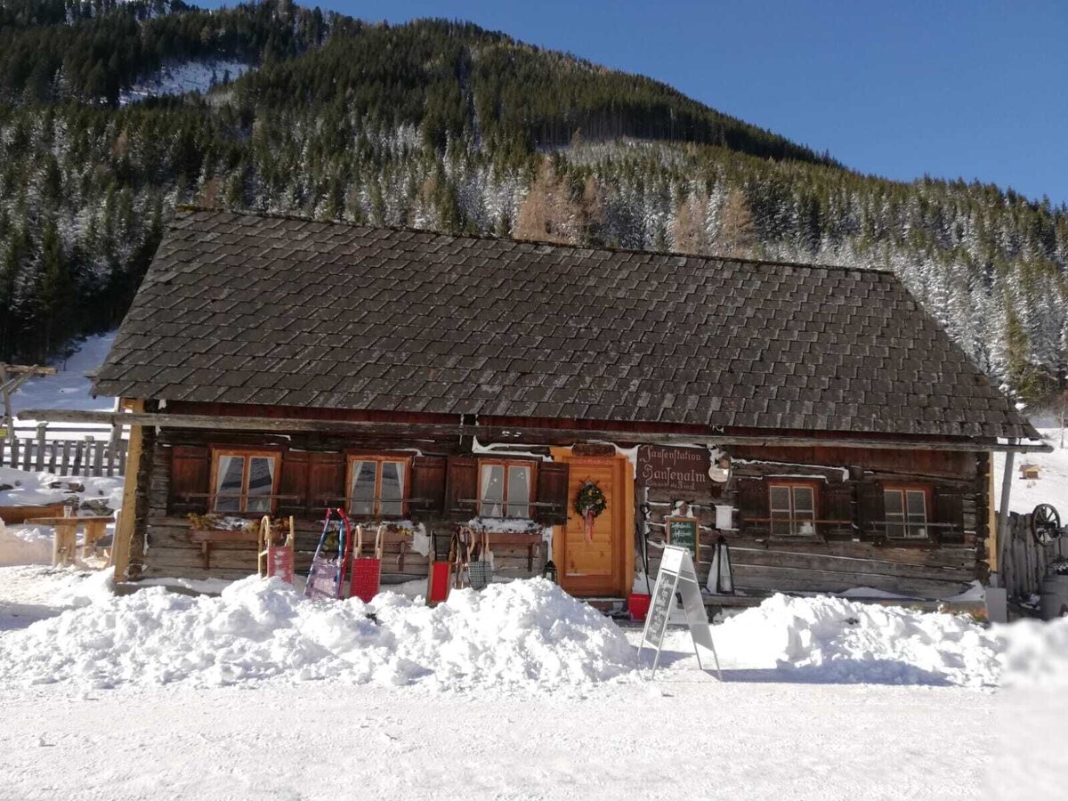
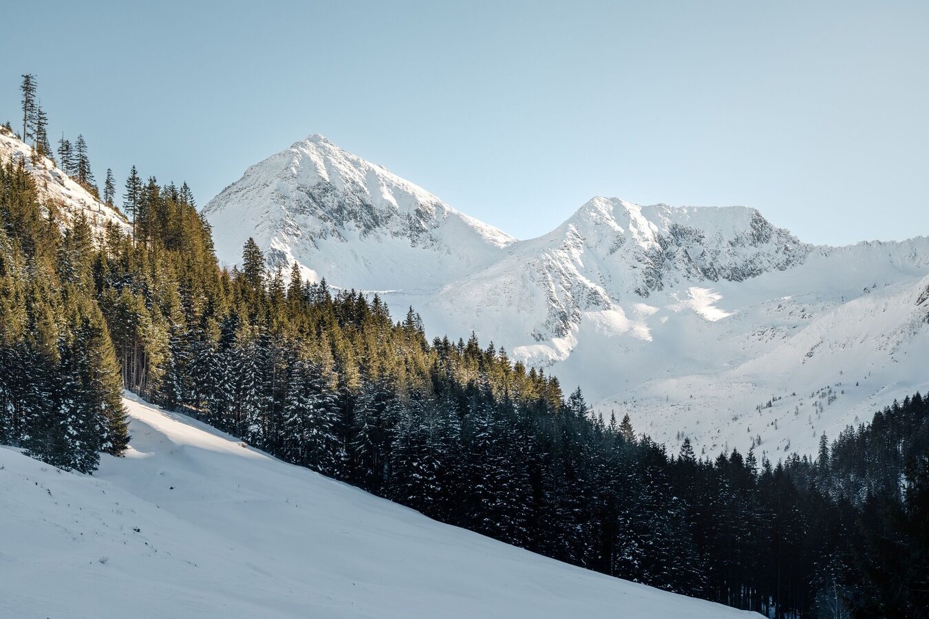
You start in St. Nikolai and you follow the federal road towards the Sölkpass to the Hansenalm about 1 kilometre.
The tour
Map, elevation profile & further information
Starting from the parking lot in St. Nikolai, hike along the street (1 km) to the Hansenalm.
Arrival at Stein/Enns train station with ÖBB.
Cab Stefan Mayer: +43 676 54 09 858
Valley bus from July 5 to September 7, 2025 - this makes crossings in the Sölktäler Nature Park possible. You can also travel comfortably by train and the valley bus will take you to the starting point of your hike. Click here for the timetable.
Wetterumstürze, rascher Temperaturabfall, Gewitter, Wind, Nebel und Schneefelder sind objektive Gefahren und erfordern das richtige Verhalten unterwegs. Hüttenwirte sind erfahrene Bergkenner, sie können gute Tipps zum Wetter und zum Wegverlauf geben. Mangelnde Ausrüstung, Selbstüberschätzung, Leichtsinn, schlechte Kondition und eine falsche Einschätzung können zu kritischen Situationen führen. Bei Gewitter: Gipfel, Kammlagen und Seilsicherungen unbedingt meiden.
GPS-Daten und Orientierungshilfen: Verfügbare GPS-Daten sind – wie auch Wanderkarten – nur eine Orientierungshilfe, da diese nie ein genaues Abbild oder den Detailreichtum eines Weges in der Wirklichkeit darstellen können. Gerade bei Gefahrenstellen muss deshalb am Ende immer anhand der Gegebenheiten vor Ort entschieden werden, ob und wie der weitere Wegverlauf aussieht.
Im
Notfall bitte folgende Notrufe wählen:
Nummer 140 - für
alpine Notfälle - österreichweit
Nummer 112 - Euro Notruf GSM Notrufservice
Nimm regenfestes und warmes Gewand und genügend Wasser, eventuell auch eine Jause mit, trage Schuhe mit rutschfesten Profilsohlen. Auch ein Erste Hilfe Paket soll im Rucksack sein.
Hier findest Du Tipps für die richtige Wahl der Wanderschuhe.
SummitLynx - Your digital summit and hut book - available worldwide and always with you!
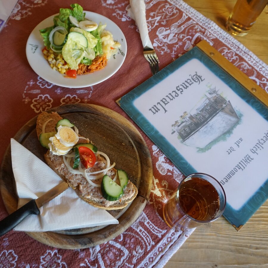
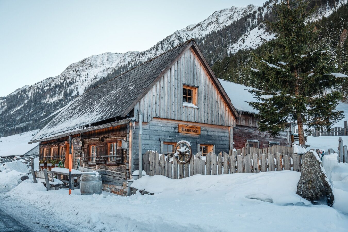
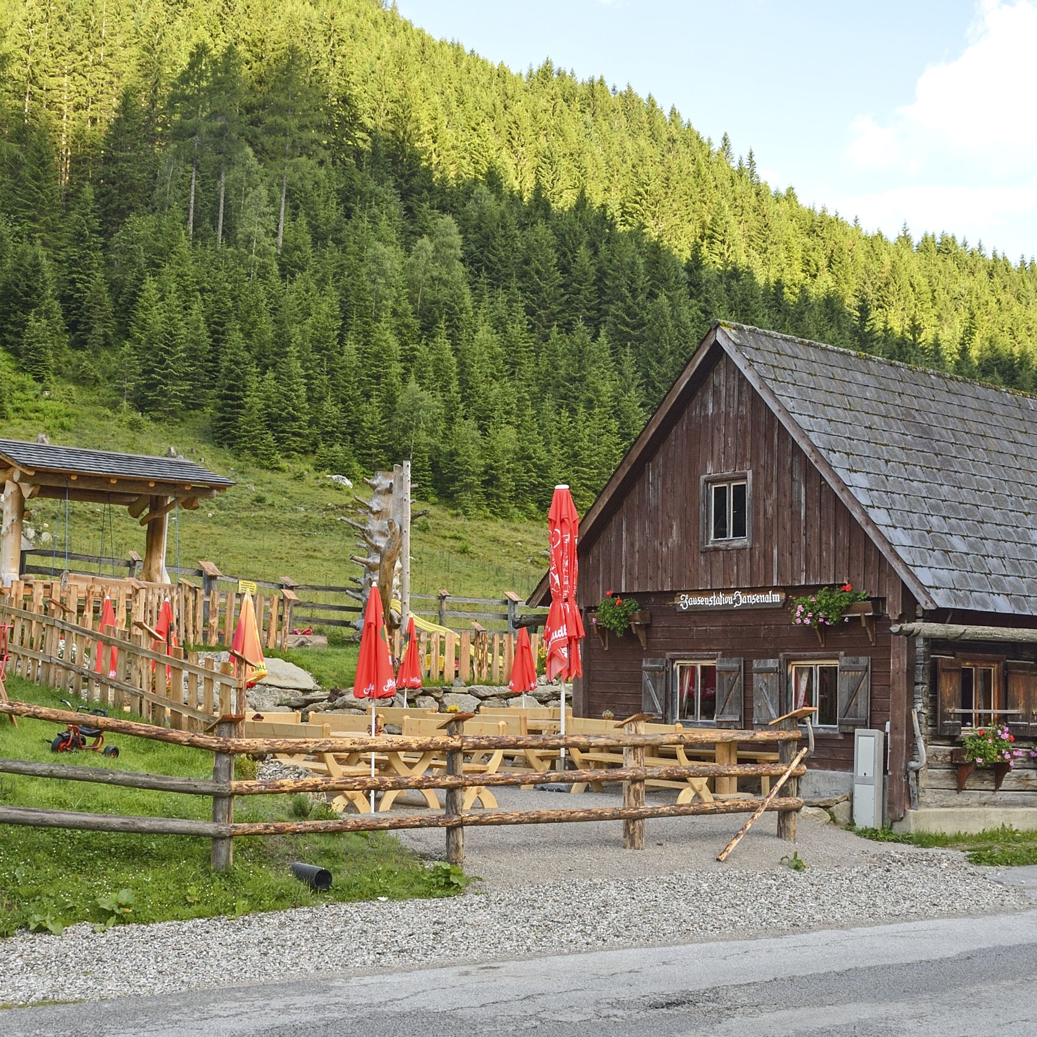
The Hansenalm spoils you with homemade specialties. Click here for the opening hours.
Mountain guides from the region: www.schladming-dachstein.at/mountainguides
For more information, please contact the Schladming Dachstein Tourist Office - Sölktäler Nature Park Information Center:
Phone: +43 3687 23310 501
mailto:info@schladming-dachstein.at
Stein an der Enns 107
8961 Sölk
The brochure “Schladming-Dachstein Hiking” is available in all information offices in the region.


