Grimming-Donnersbachtal
Grimming via Southeast degree
Mountain tour
Data:
Tour description
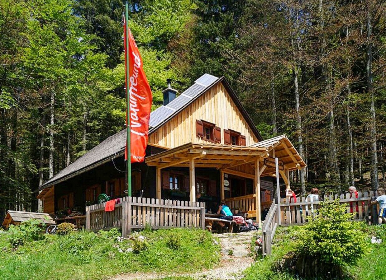
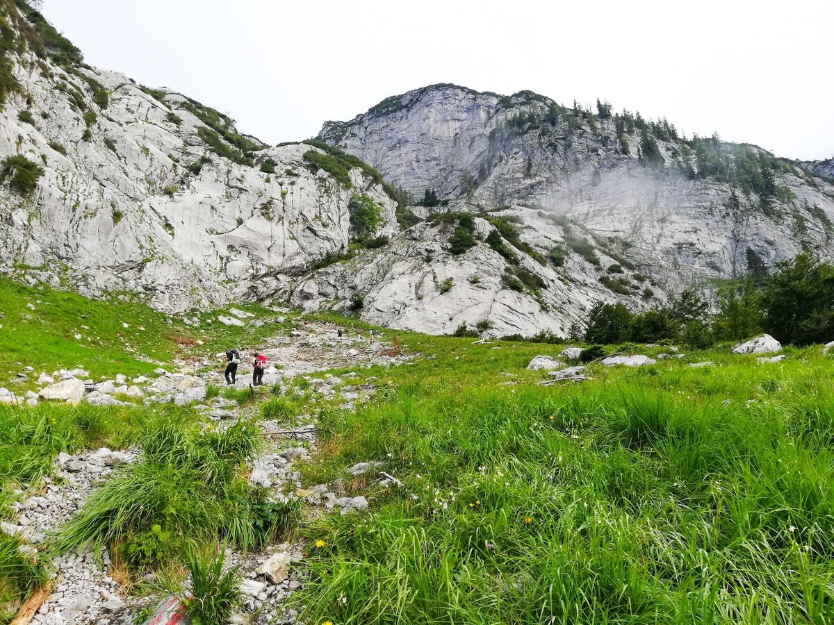
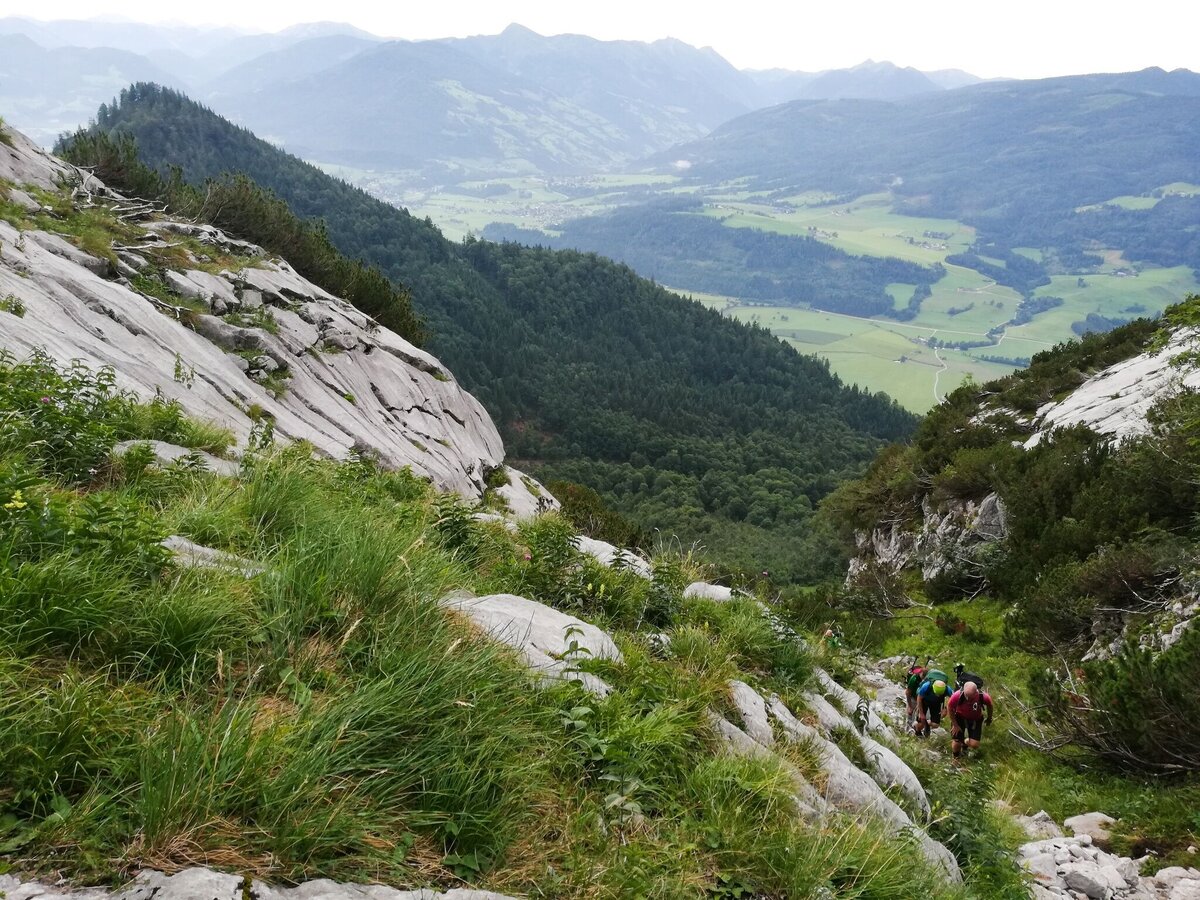
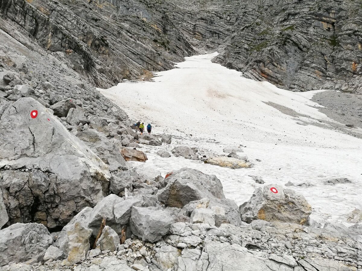
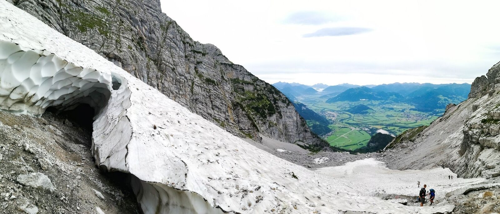
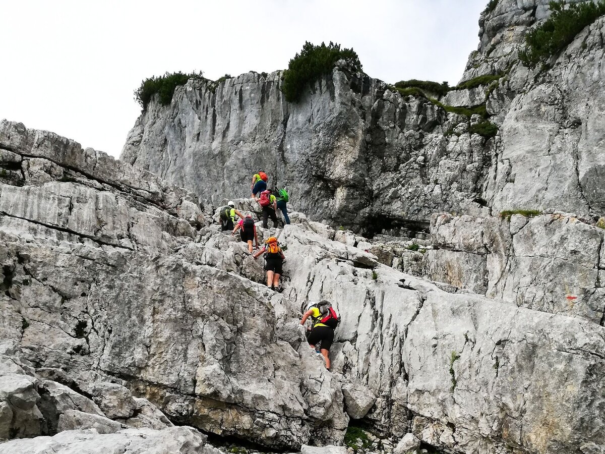
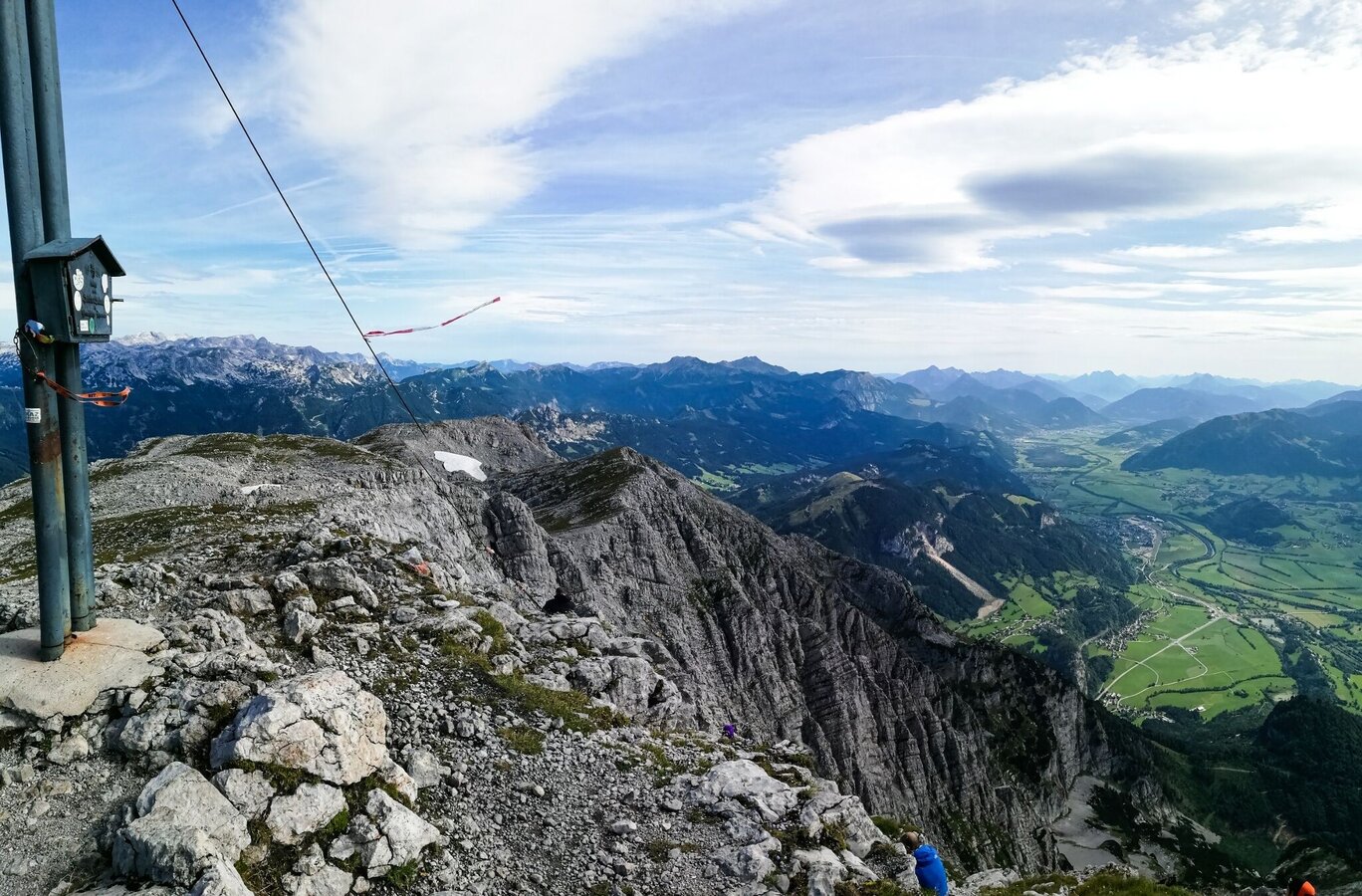
THE TIGHTEST ascent to the mountain of mountains is the southeast ridge. After the Grimminghütte, it's over ladders and mountain pines to the snow pit and further over the slab ramp on the ridge. Over several climbing passages you come to the summit cross, where already 2 351 endorphins are waiting for you. Simply phenomenal!
The tour
difficult
Starting point
Parking Castle Trauetenfels
Destination
Parking Castle Trautenfels
Tour characteristics
Fitness (5/6)
Information
Distance: 12.97 km
Duration:
9 h
Ascent: 1703 m
Descent: 1703 m
highest point: 2351 m
Best season
Jan
Feb
Mar
Apr
May
Jun
Jul
Aug
Sep
Oct
Nov
Dec
Map, elevation profile & further information
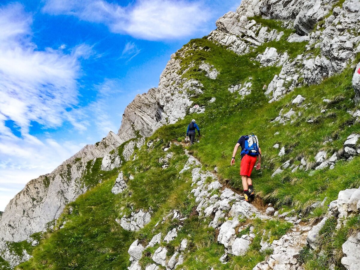
The most difficult climb on the Grimming is the southeast ridge. Early in the morning you march from the parking lot Schloss Trautenfels, following the markings to the Grimminghütte. After the hut you walk up ladders and mountain pines to the fork and turn left to the Schneegrube. Then you come over the slab ramp to the ridge. The steep climb leads you over several climbing passages (1+/2+) directly to the summit cross. The descent is either to the north or via the Multereck. On both descents there are easy climbing sections and rope-secured sections to master.
Coming from Liezen on the B 320 at the Trautenfels traffic circle take the exit towards Irdning and after about 300 m turn right and drive to the Trautenfels Castle Museum.Free Parking at the castle Trautenfels
From the trainsation stainach or busstop irdning, do you have a connection.
- Plan your tour in advance, taking into account walking time, route length, altitude difference, danger spots and weather forecast.Together is much more beautiful and at the same time safer in the mountains.
- Do not go alone, if possible, and adapt the tour to the ability of your group.
- Let them know where you are going and when you want to be back. Also sign hut or summit books.
- Turn back in good time if the weather deteriorates. If you get caught in a thunderstorm, do not stay on the summit or ridge and stay away from individual trees. Wait out the storm, if possible in a crouching position.
- Stay on the marked trails and remember to close pasture fences again.
- Getting up the trail is only half the battle. Stay alert, especially on the descents, to make it back to the valley safely.In case of emergency, keep calm and call the mountain rescue on 140. If you have no reception, take out the sim card and dial 112.
- If you encounter cows: It is best to pass above the herd with at least 50 meters distance. Stay calm, don't make any frantic movements and don't run away. Do not imitate cow sounds and do not try to pet the animals. A stick and loud shouting can often make the animals turn back in an emergency.
- If you are a dog owner: Clarify before the hike if you have to cross a pasture. Keep your dog on a leash and make sure he stays calm. If a cow attacks, let the dog off the leash immediately. Never pick him up to defend him.
- You can get detailed information on "Safe Mountain Hiking" from the Alpine Club. At www.alpenverein.at you can inform yourself comprehensively about it.
For the Grimming climb, a helmet is also a must.
Early Birds a winner, on hot days: Start on the right time, or sleep on the grimminghütte, than you less one hour walking timeTourism information: www.schladming-dachstein.at
Tourism blog: www.derbergdastal.at
Tourist Office Schladming-Dachstein
Ramsauerstrasse 756
8970 Schladming
T: +43 3687 23310
info@schladming-dachstein.at
Garbage on meadows and paths can not smell mountain and valley. Please take it with you. Agriculture and forestry are important partners for Berg und Tal. They allow you to walk and drive on many of their paths. Be aware that only good cooperation will guarantee your recreational enjoyment in the future.
- GRIMMING-DONNERSBACHTAL Hiking & Biking Map. Available free of charge at the tourist offices of Berg & Tal
- SCHLADMING-DACHSTEIN Hiking Map
- KOMPASS Hiking Map No. 68, Ausseerland-Ennstal Valley


