3-lakes-hike to the Kaltenbachseen
Tour description
The tour
Map, elevation profile & further information
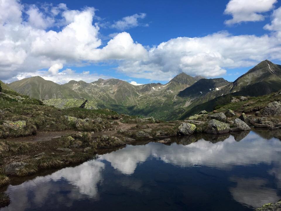
Above the tree line the path leads over a long slope up to the upper Kaltenbachsee. Walking time a little more than 1 hour. This lake has a clear alpine character, but is a wonderful place to stay.
However, the next destinations are no less attractive: on the left bank ridge it goes steeply up again over a rocky spur into a small cirque, of course also with a little lake, which in early summer is very charmingly surrounded by yellow marsh marigolds.
Arrival at Stein/Enns train station with ÖBB.
Cab Stefan Mayer: +43 676 54 09 858
Valley bus from July 5 to September 7, 2025 - this makes crossings in the Sölktäler Nature Park possible. You can also travel comfortably by train and the valley bus will take you to the starting point of your hike. Click here for the timetable.
In the area of the Sölkpass you can meet free-roaming grazing cattle. Caution is required, especially with dogs.
Weather changes, rapid drop in temperature, thunderstorms, wind, fog and snow fields are objective dangers and require the right behavior on the way. Hut keepers are experienced mountain connoisseurs, they can give good tips on the weather and the course of the trail. Lack of equipment, overestimation of one's own abilities, carelessness, poor physical condition and a wrong assessment can lead to critical situations. During thunderstorms: avoid peaks, ridges and rope belays at all costs.
GPS data and orientation aids: Available GPS data - as well as hiking maps - are only an orientation aid, since they can never represent an exact image or the richness of detail of a path in reality. Especially in the case of danger spots, it must therefore always be decided in the end on the basis of the conditions on site whether and how the further course of the path looks like.
In case of emergency, please dial the following
emergency numbers:
No. 140 - for alpine emergencies - Austria-wide
No. 112 - Euro emergency call GSM emergency call service
Take rainproof and warm clothes and enough water, possibly also a snack, wear shoes with non-slip profile soles. A first aid kit should also be in your backpack.
SummitLynx- Your digital summit and hut book - available worldwide and always with you!
After a strenuous hike, you can regain your strength with a refreshment at the Kaltenbachalm, Winkleralm, Mautneralm oder Hansenalm!Mountain guides from the region: www.schladming-dachstein.at/mountainguides
For more information, please contact the Schladming Dachstein Tourist Office - Sölktäler Nature Park Information Center:
Phone: +43 3687 23310 501
mailto:info@schladming-dachstein.at
Stein an der Enns 107
8961 Sölk
The brochure “Schladming-Dachstein Hiking” is available in all information offices in the region.


