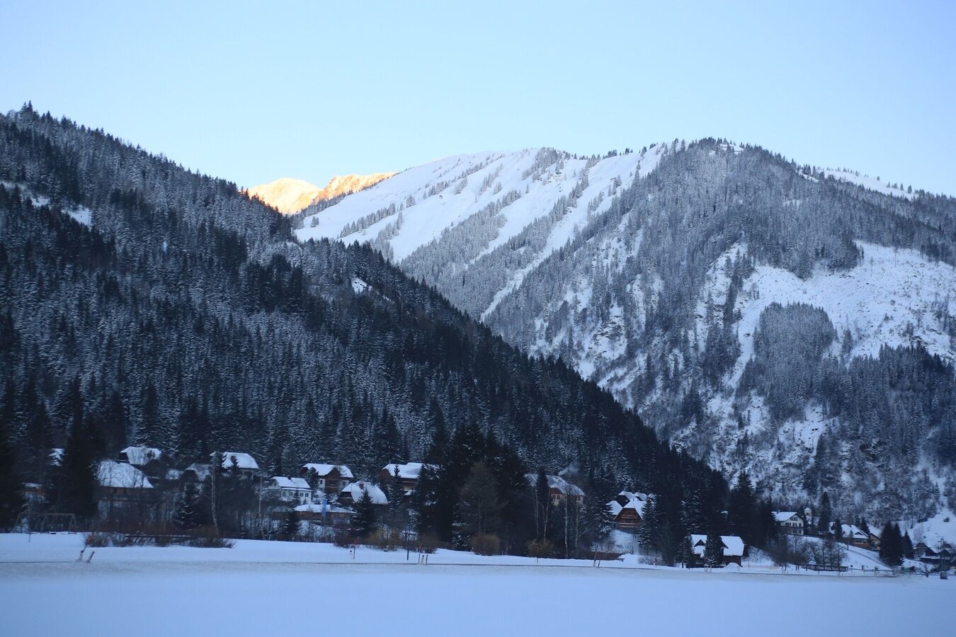
Grimming-Donnersbachtal
Winter hiking to Hinterwald
Winter sports
Data:
Tour description
Shared joy makes you twice as happy. Along this hike, the section on the cross-country ski trail Hinterwald to Schaupphof and on the right bank of the stream back to the village is extra wide tracked, so that not only cross-country skiers but also you as a winter hiker can discover this part of Donnersbachwald.
The tour
easy
tour.detail.accessible-by-public-transport
Starting point
Local center or Riesneralm
Destination
At the starting point
Tour characteristics
Information
Distance: 5.83 km
Duration:
2 h
Ascent: 50 m
Descent: 50 m
highest point: 1011 m
Best season
Jan
Feb
Mar
Apr
May
Jun
Jul
Aug
Sep
Oct
Nov
Dec
Map, elevation profile & further information
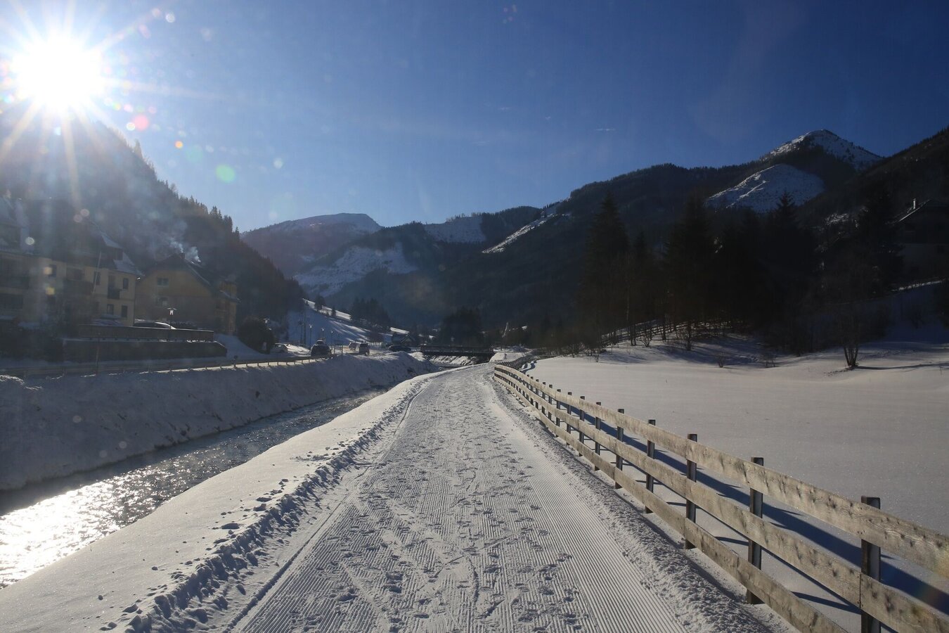
Along this hike, the section of the ‘Hinterwald trail’ from the Riesneralm to the Schaupphof and along the right bank of the stream back to the village is extra wide. This means that winter hikers and cross-country skiers can also discover this part of Donnersbachwald.
Please do not step into the cross-country ski tracks!!!
Please do not step into the cross-country ski tracks!!!
From the Ennstalbundesstraße (B320) turn off at the Trautenfels junction in the direction of Irdning, Donnersbach, Donnersbachwald. Through the village of Donnersbach and another 12 km to Donnersbachwald.Free parking at the large parking lot in the center of village or at the Riesneralm parking lot.
Take the 941 bus to the "Donnersbachwald Ort" or "Riesneralm Talstation" bus stop. There is also the starting point of the hike.
Bus schedule: www.verbundlinie.at
Bus schedule: www.verbundlinie.at
The nearest train station "Stainach-Irdning" is about 22 kilometers away in Stainach.
Train timetable: www.oebb.at
In winter, caution is advised even on seemingly easy hikes. In shady areas, the ground can be slightly icy, and there may be avalanche danger below slopes. Mountaineering is therefore primarily a matter of personal responsibility – even more so in winter. Tourist associations and avalanche warning services assume no liability whatsoever based on the information provided.
Your equipment should ideally include:
Your equipment should ideally include:
- Ankle-high, warm shoes. Waterproof, warm shoes with a treaded sole are ideal. Optional: Gaiters for additional snow protection.
- A hood and warm clothing, ideally layered. Don't forget a change of clothes for longer winter hikes: a wind and waterproof jacket and trousers.
- A small backpack with a warm drink in a thermos and snacks as needed
- Sun protection
- Cell phone
- First aid kit
- Optional: crampons/snow spikes (snow chains for shoes), telescopic hiking poles for better grip and balance.
Actually not a tip but a request: For a good cooperation and the preservation of the trail track please keep to the outer edge of the trail. Thank you!
Tourist information: www.schladming-dachstein.at
Schladming-Dachstein Tourist Office
Ramsauerstraße 756
8970 Schladming
T: +43 3687 23310
info@schladming-dachstein.at
Schladming-Dachstein OST winter adventure map, available from the information offices in the region.


