Ski tour to the Hochwart

Tour description
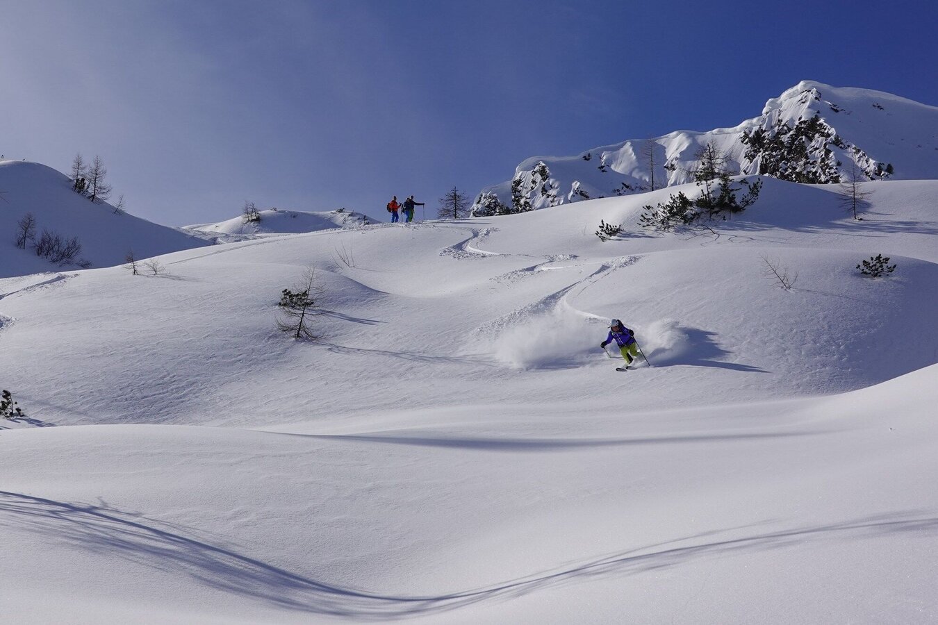
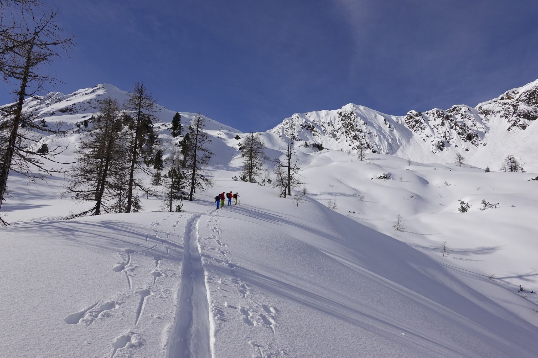
At the beginning of the tour, a good forest road is the order of the day. But then you are well warmed up when it continues over steep steps in impressive alpine surroundings towards the summit. At the top, you can collect your reward, because a fantastic panoramic view opens up from here.
The tour
Map, elevation profile & further information
From the Riedleralm barrier, follow the forest road to the Ebenbachalm. Always keep to the right of the Ebenbach stream. Shortly after the hunting lodge you climb uphill through sparse forest to the dilapidated Zettlerhütte. This is followed by a flat area before the next ascent to an alpine pasture awaits you. Over stepped terrain it goes medium steep, before the degree steep, towards the summit.
The subsequent descent is via the ascent route, or you cross the Ebenbach shortly before the hunting lodge and descend on the left side of the stream. Either way a pleasure.
From the Ennstalbundesstraße (B320) turn off at the Trautenfels junction in the direction of Irdning, Donnersbach, Donnersbachwald. Through the village of Donnersbach and another 12 km to Donnersbachwald. Past the Riesneralm and about 3.5 km to Hinterwald to the barrier Riedleralm.
Approx. 10 parking spaces next to the road just before the timber yard. Larger groups please park at the Riesneralm parking lot and drive to the starting point with as few cars as possible. Do not park at the timber yard!
Unfortunately, there is no public transport to the starting point of the ski tour.
Mountain sports and the assessment of the situation on site are - even more so in winter - primarily subject to personal responsibility. Tourism associations or avalanche warning services do not assume any liability based on the information provided.
- Check the weather and avalanche situation at www.lawine-steiermark.at before each ski tour.
- The use of the tour description is at your own risk and responsibility.
- Do not go on a ski tour alone. It's more fun together anyway!
- Always behave risk-conscious and react to danger signs!
- Respect existing regulations, such as hunting and game protection areas, reforestation or young growth areas.
- You should always have your cell phone well charged. Do you have the emergency numbers saved? Mountain rescue: 140. If you have no reception, take out the sim card and dial 112.
- Avalanche beacon, probe and shovel are essential in open terrain.
- Ski touring equipment consisting of skis/splitboard, skins, poles and possibly crampons.
- Food, warm drinks, spare clothing and a first aid kit.
- Choose your clothing according to the onion layer principle.
- Maps and/or tour descriptions. GPX tracks on your mobile phone or GPS device are also helpful.
- You can rent ski touring and safety equipment from Sport Scherz and Sport Schöttl.
When descending, cross the Ebenbach shortly before the hunting lodge and descend on the left side of the stream. This way you always have the sun on your side.
Tourism information: www.schladming-dachstein.at
Tourist Office Schladming-Dachstein
Ramsauerstrasse 756
8970 Schladming
T: +43 3687 23310
Garbage on meadows and paths can not smell mountain and valley. Please take it with you. Agriculture and forestry are important partners for Berg und Tal. They allow you to walk and drive on many of their paths. Be aware that only good cooperation will guarantee your recreational enjoyment in the future.
Sport ScherzAt Riesneralm, Planneralm and in Wörschach+43 (0)3682 22383sport-scherz.at
Sport SchöttlAt Planneralm and in Irdning+43 (0)3682 22952 0sport.schoettl.at
Guided ski tours and freeride courses also at www.magicsnow.at
KOMPASS Map 68, Ausseerland-Ennstal 1:50.000, Hiking, Biking, Ski tours


