Schladminger Tauern Trail

Tour description
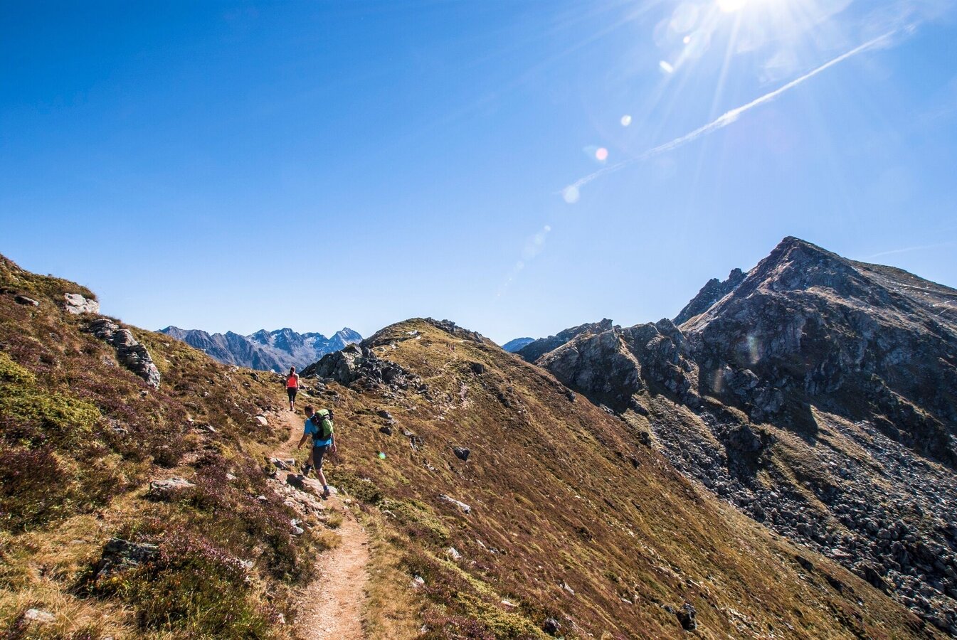
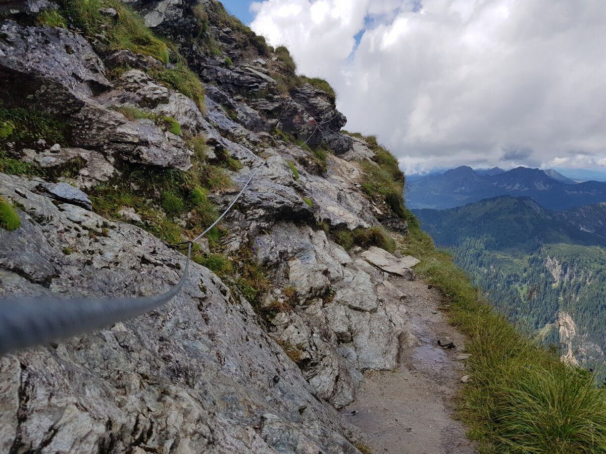
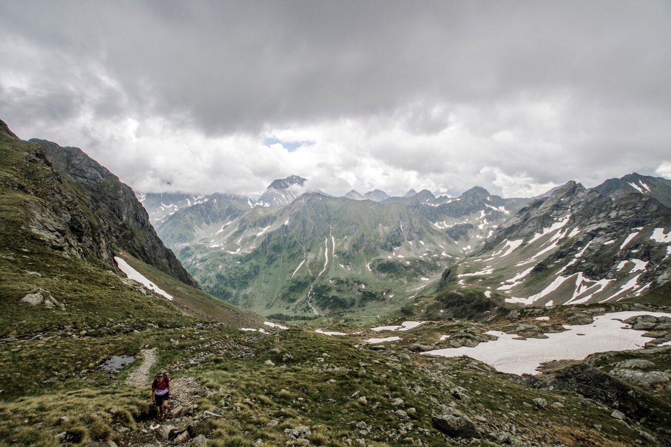
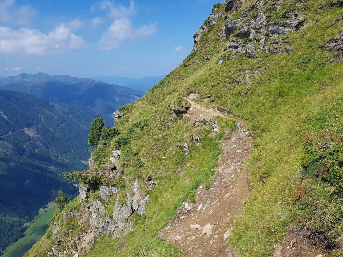
The Schladminger Tauern Trail is a trailrun of the "x-Treme" category and is only suitable for very advanced trailruners and pros. The route is identical with the 5-day (!) hiking tour on the Schladminger Tauern High Trail. This trail almost exclusively runs along narrow paths and high alpine trails. Some sections have steel ropes for security reasons while you are running through highly exposed terrain. On top of that, you may encounter residual snow fields on the higher located passages also during the summer months.
The tour
Map, elevation profile & further information
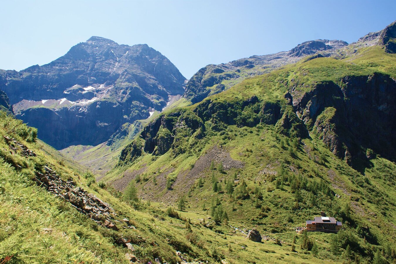
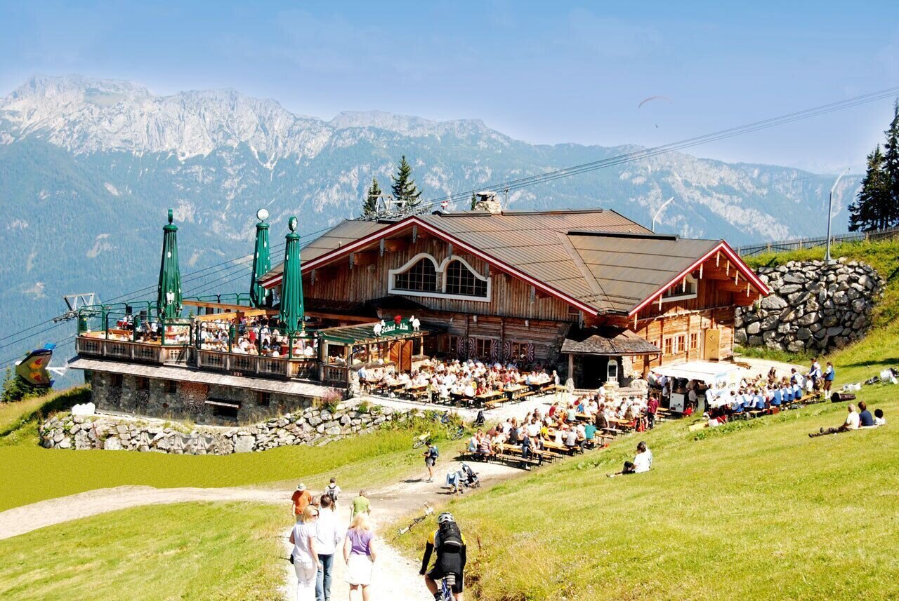
Starting point of this route is Hochwurzenhütte on the summit of Hochwurzen (1,852 m). From Schladming you take the Planai buses to the valley terminal from where the cable-car takes you up to the summit. Alternatively you can take Hochwurzen Trail (trailrun #6 equal to hiking trail #60) to the top (an additional 720 m in vertical ascent, about 1 hour).
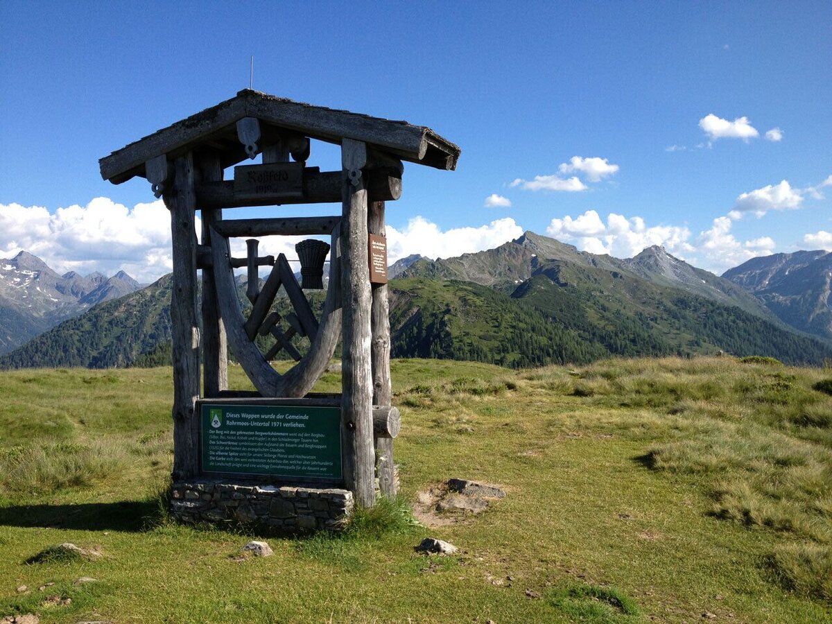
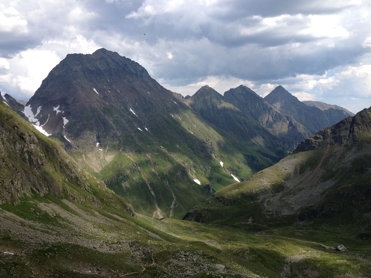
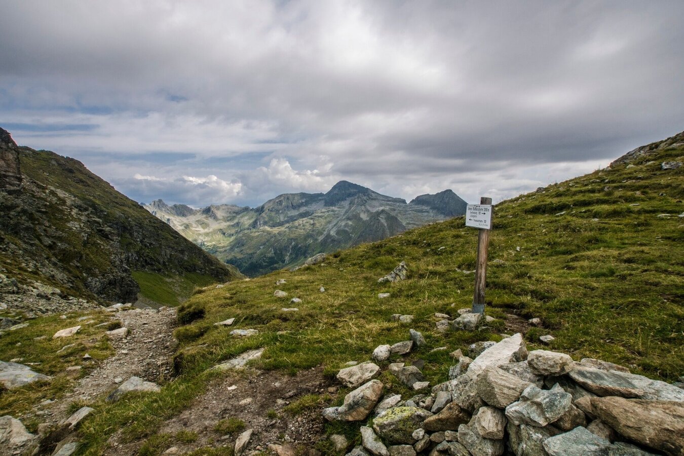
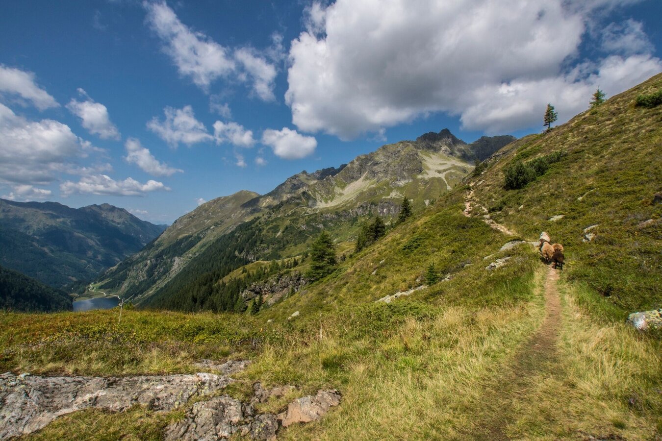
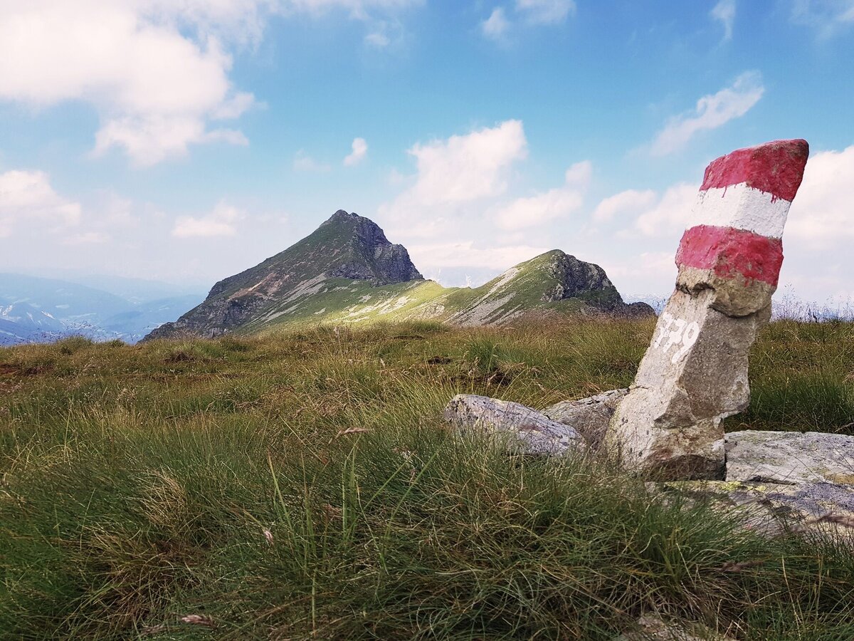
Via »Kleine Wurzen« and Hüttecksattel mountain saddle you run to Rossfeld from where you descend to Latterfußsattel and ascend back up to Guschen (1,982 m). Via trail #773 you reach Hochfeldmandl (a big stone pile) and continue along the rough flanks of Schiedeck summit (very exposed terrain!). Passing by Klammsee and Brettersee lakes you reach Ignaz-Mattis-Hütte (1,986 m) above Lower Giglachsee lake.
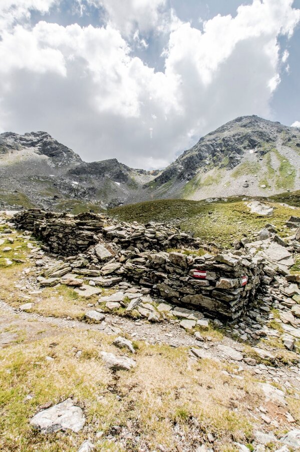
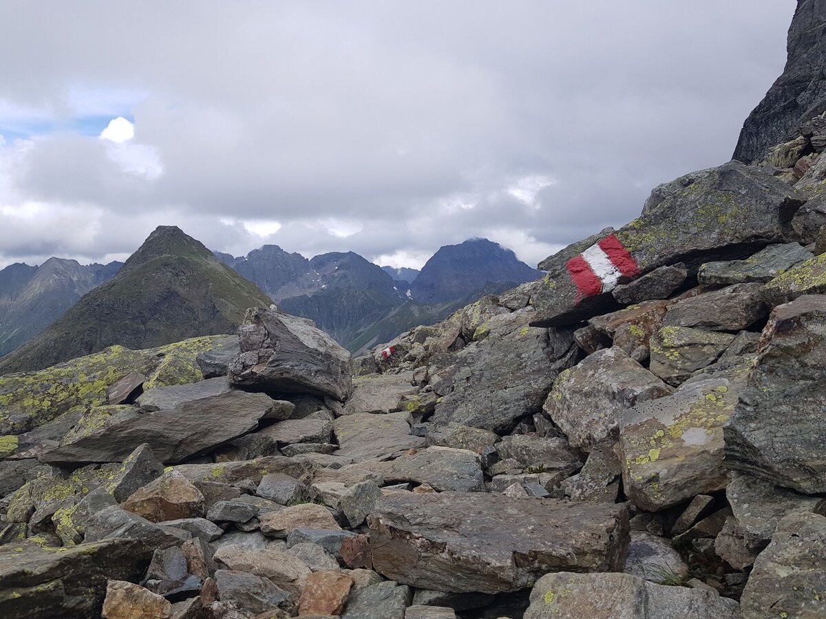
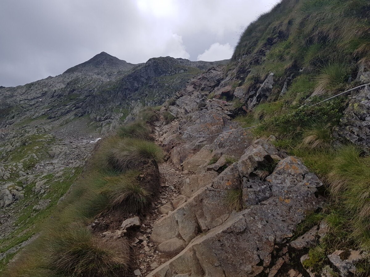
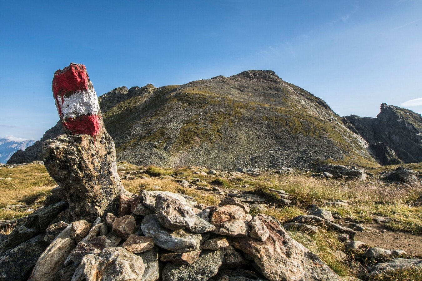
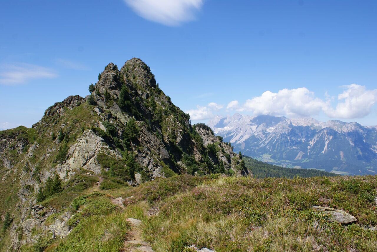
To the left (trail #702) you run to the eastern shore of the lake where you continue south (trails #702/#775) towards Rotmandlspitze summit. You run up into Vetternkar cirque - passing by ruins of miners' housing (up to the 19th century this area was the main mining district of the region). From the ruins the trail ascends steeply via several switchbacks. Be careful, the surface of the trail is made up of loose stones! you then reach the summit of Rotmandlspitze (2.453 m). Below »Sauberg« mountain you run across an extensive scree section and reach Kruckeckscharte ridge from where you descend into Neualmkar cirque and to Keinprechthütte (1,872 m).
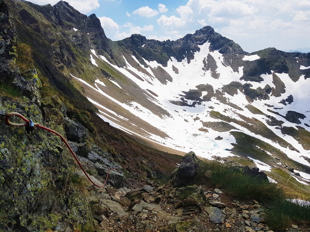
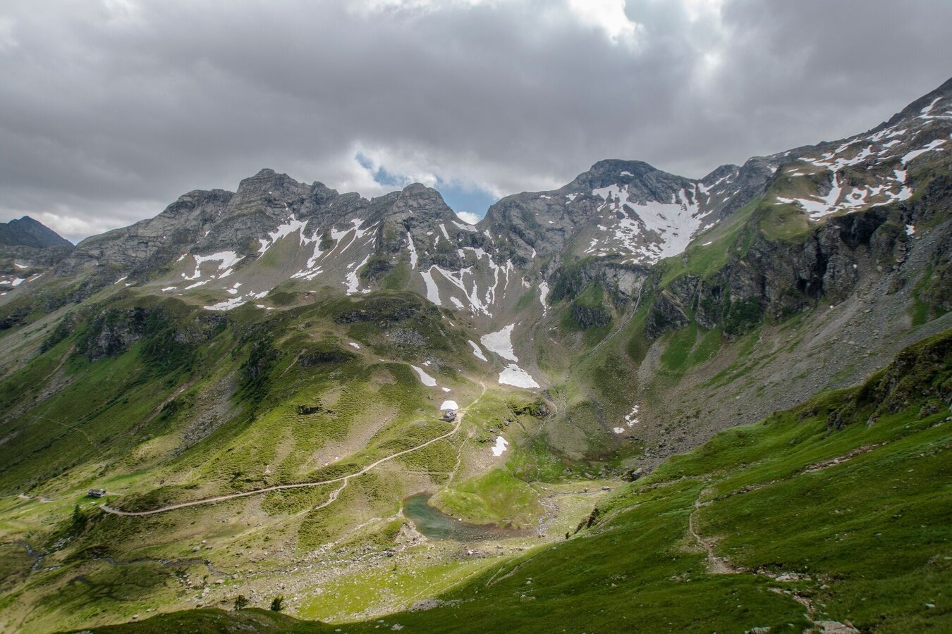
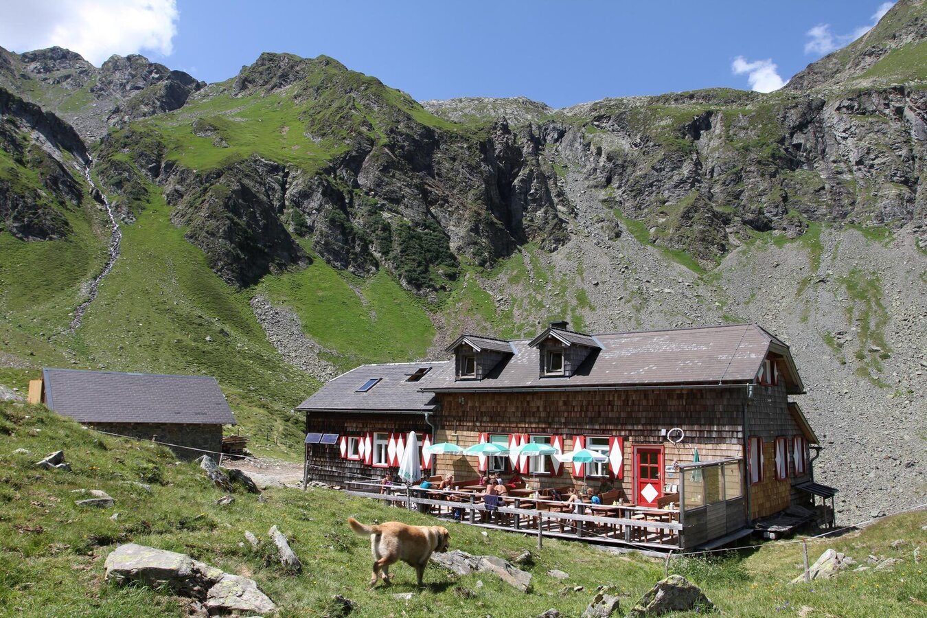
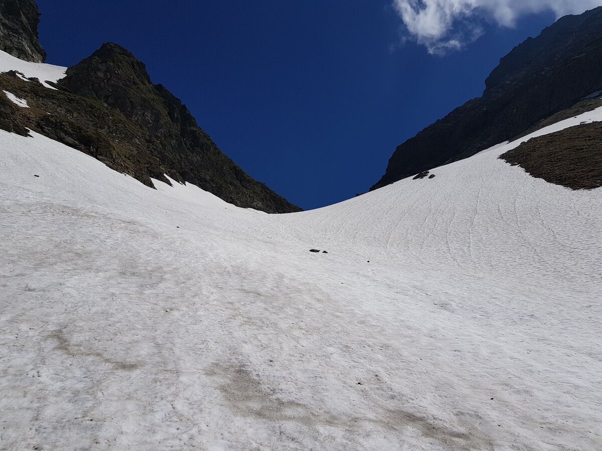
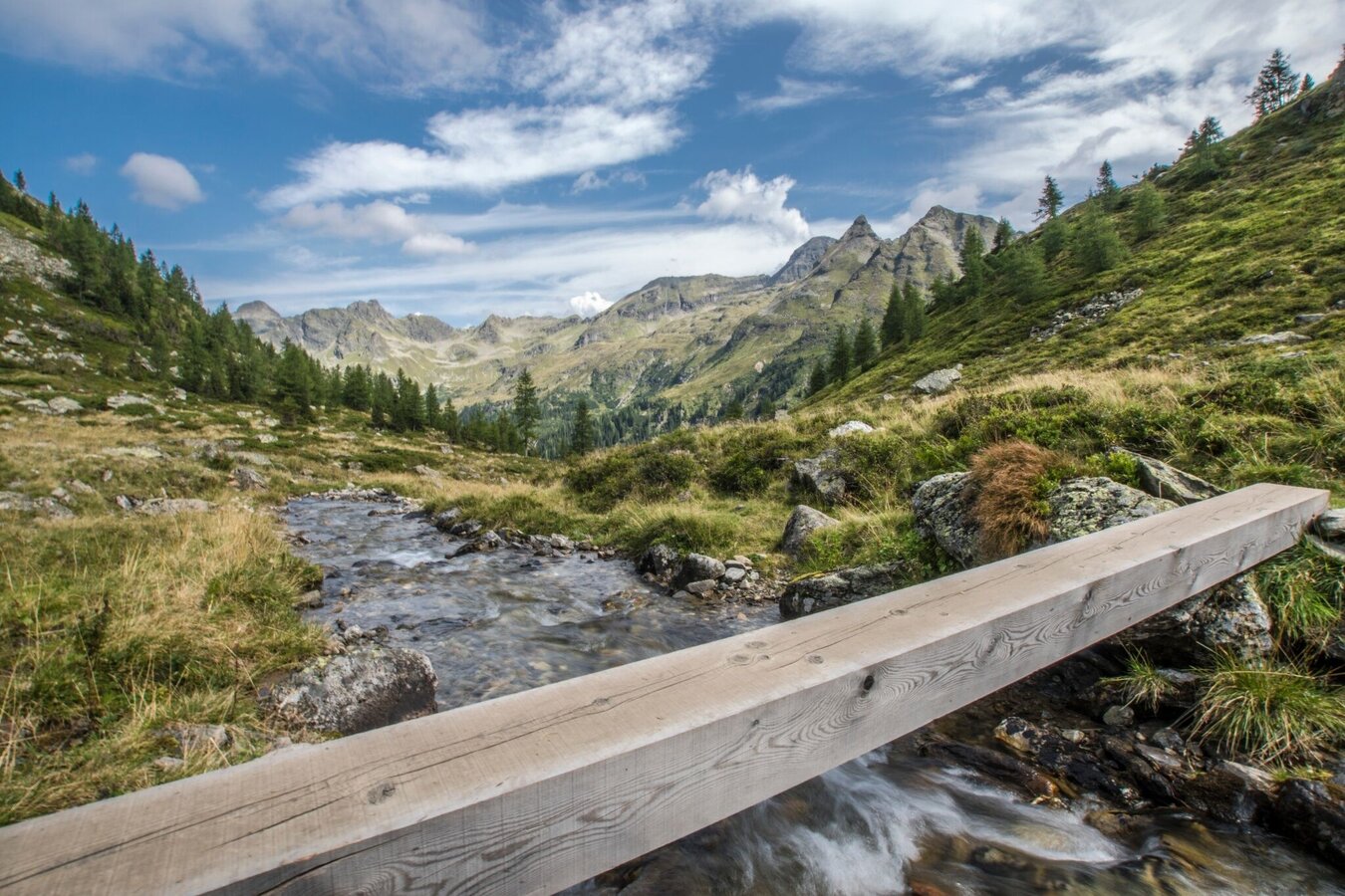
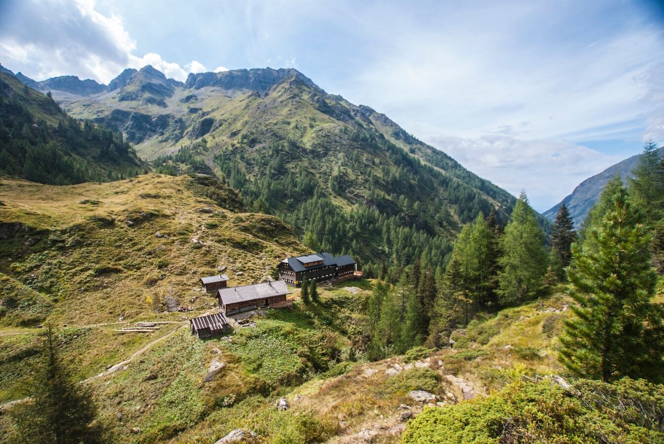
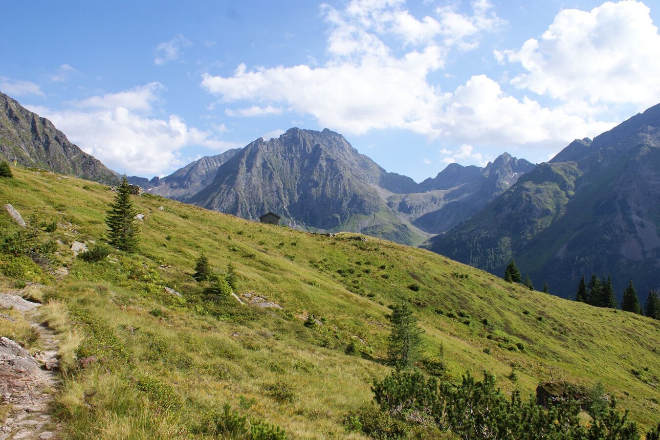
From the hut the trail takes you out above the cirque and makes a wide loop up to Trockenbrotscharte ridge (2,237 m). From the ridge you quickly reach Landawirseehütte and run down into Göriachwinkel cirque. From there the trail ascends quite steeply to Gollingscharte ridge (2,326 m) - the last part usually still having residual snow fields in early summer. From the ridge you then run down through a large scree slope and reach Gollingwinkel (a natural amphi theatre at the foot of Hochgolling's north face). From there it only takes you a couple of minutes to Gollinghütte (1,641 m).
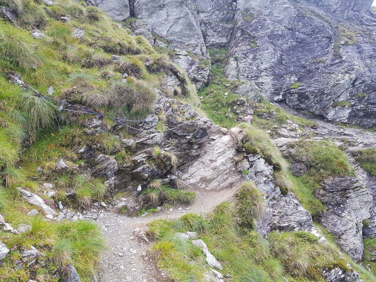
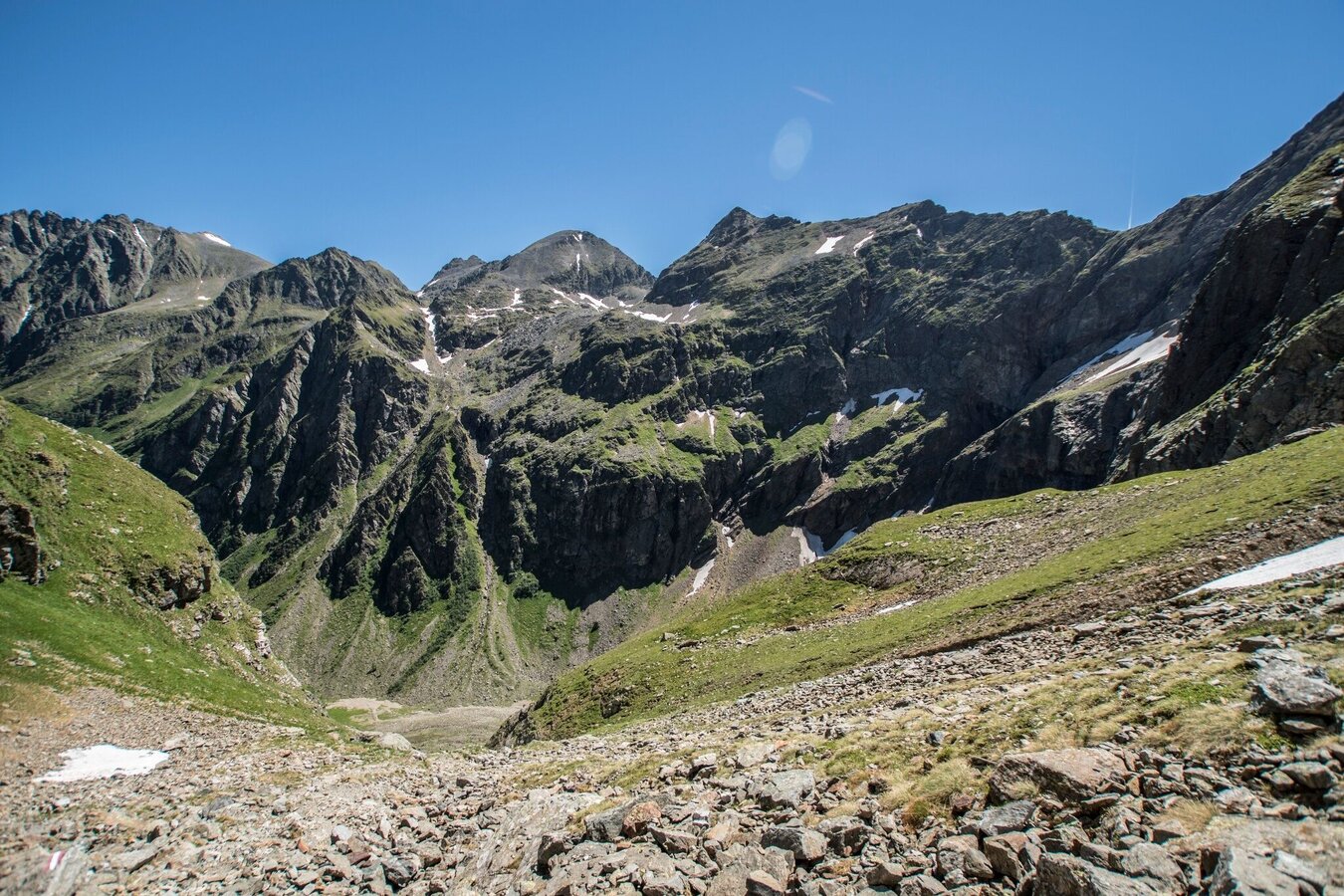
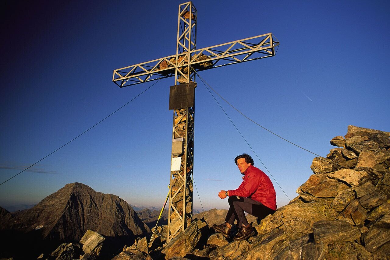
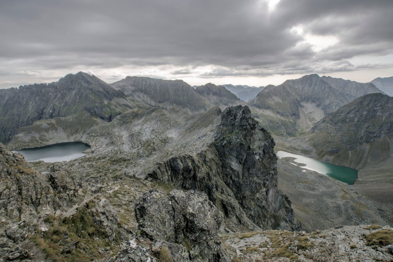
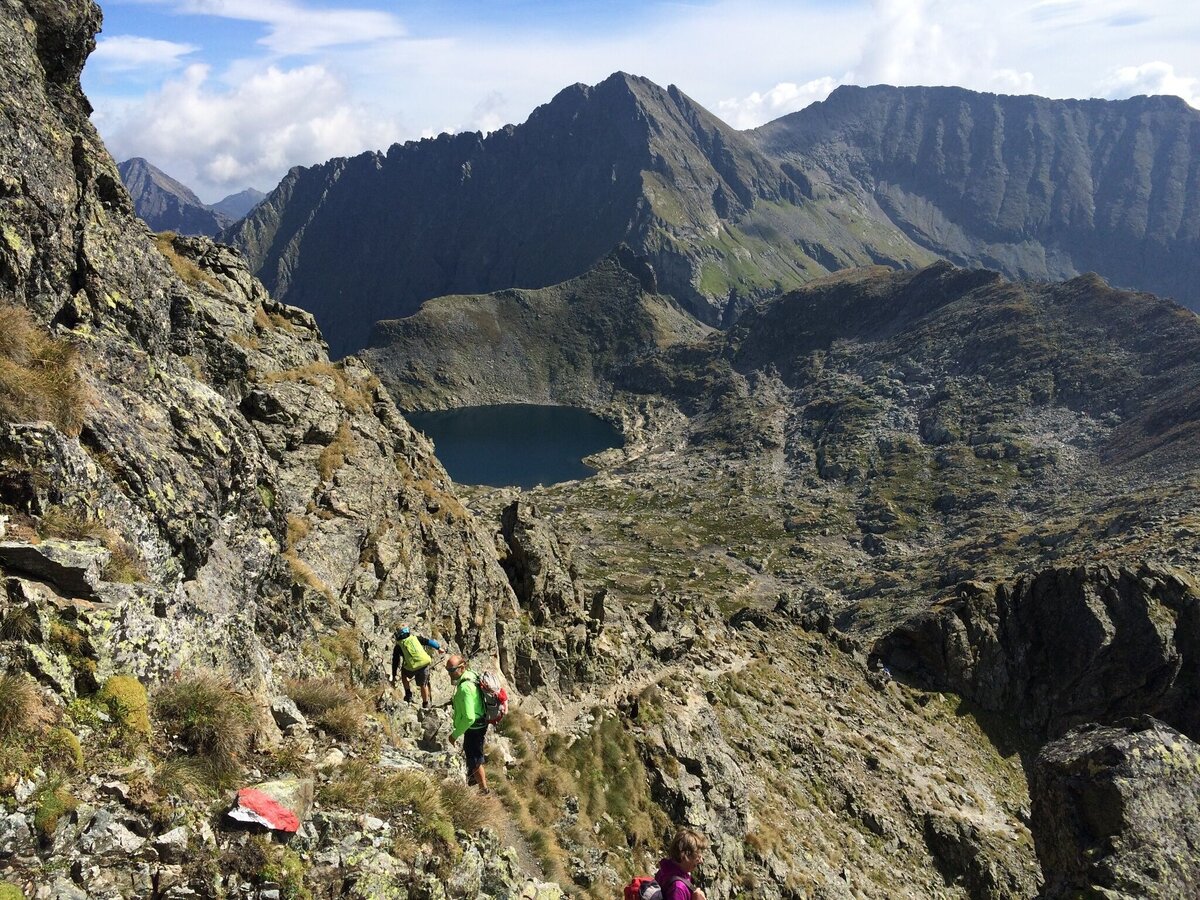
From Gollinghütte to Greifenbergsattel ridge one of the most challenging parts is waiting for you. The trail up to the mountain saddle is very steep with 800 meters in vertical ascent to cover. Once you reach the mountain saddle with a small lake it only takes a couple of minutes more to the highest point of the entire Schladminger Tauern Trail - Greifenberg at an elevation of 2,618 m. From Greifenberg summit the trail takes you downhill into Klafferkessel - a high alpine lake plateau. The trail down is rocky with loose stones and a couple of steel ropes for security reasons - be very careful here!!
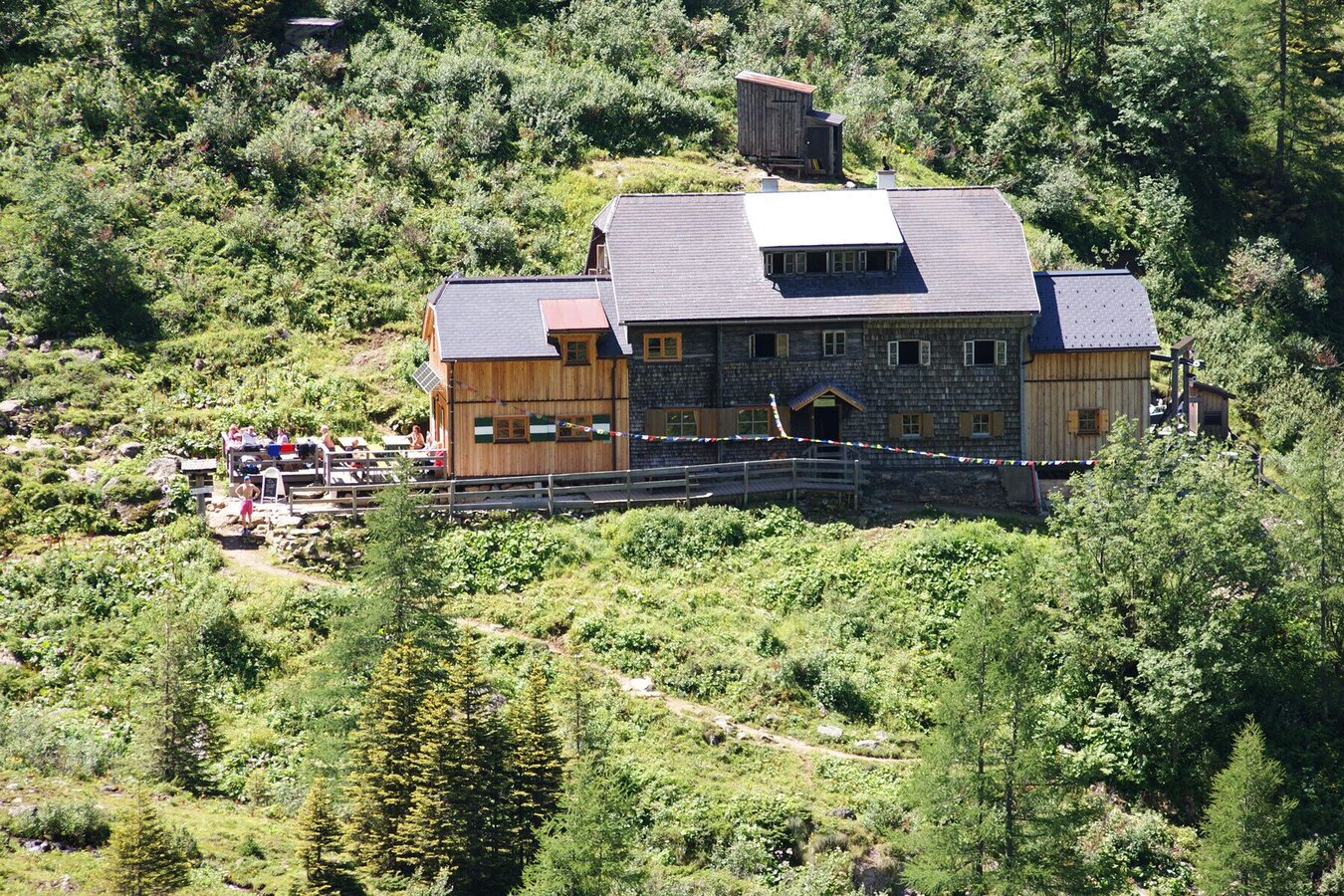
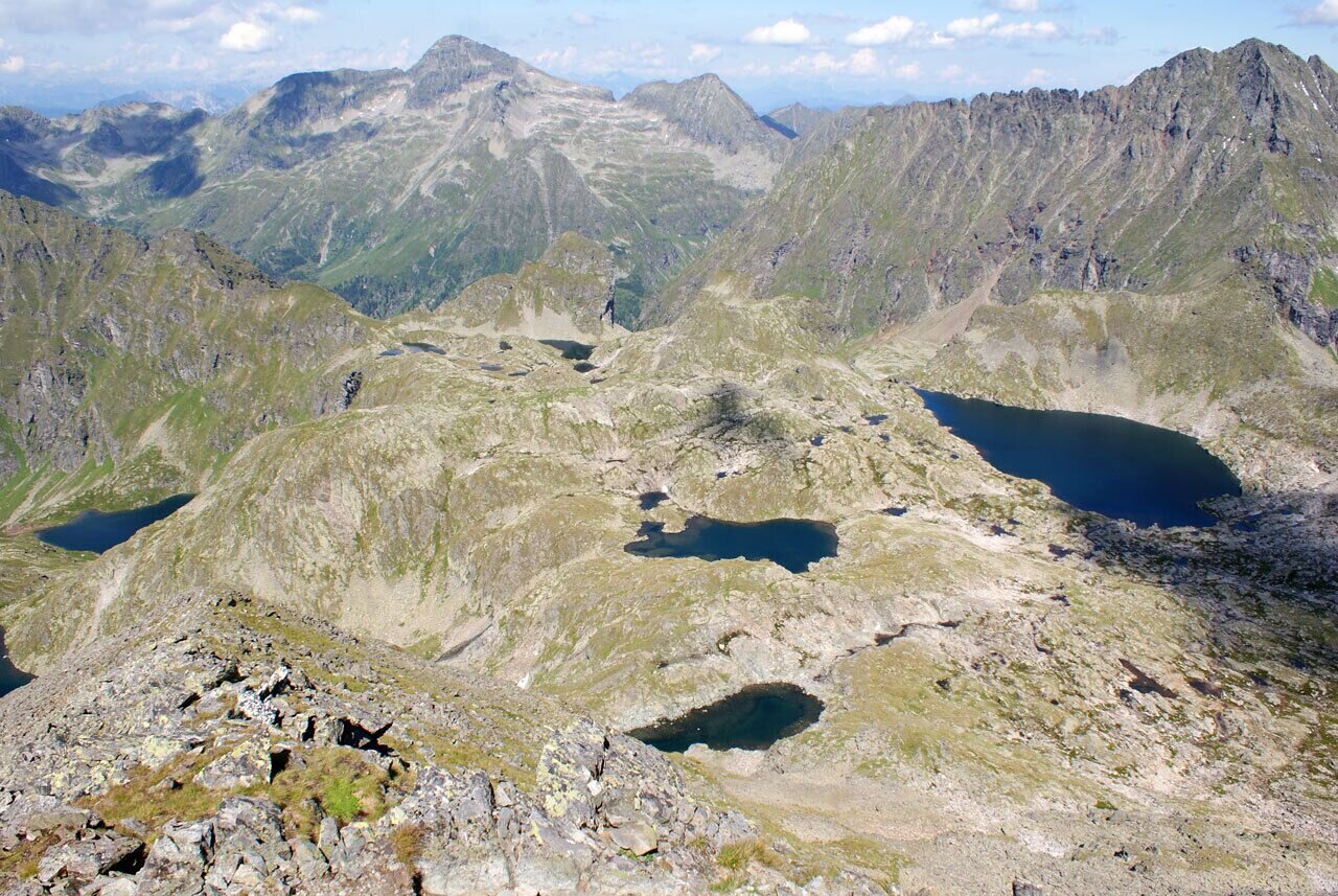
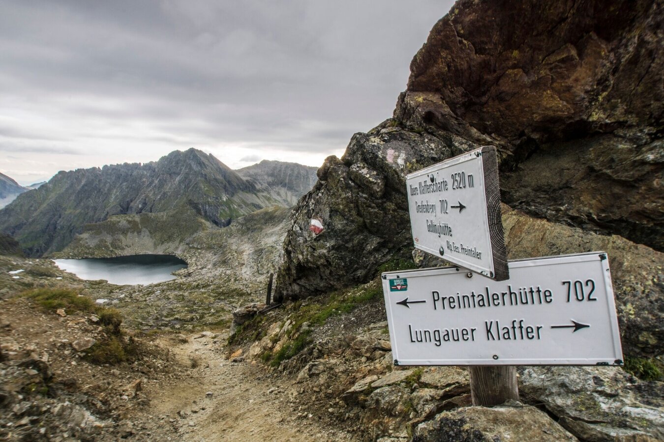
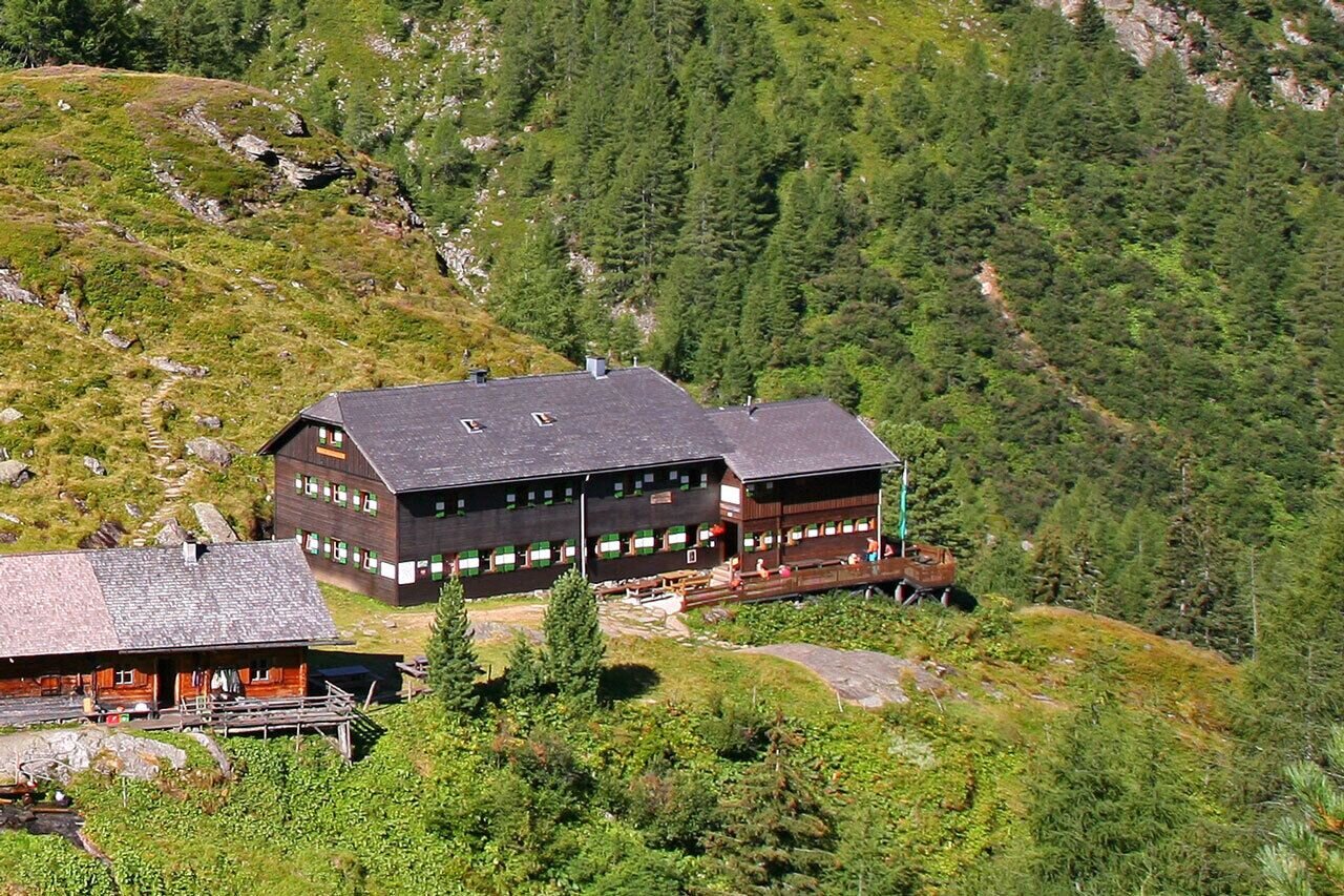
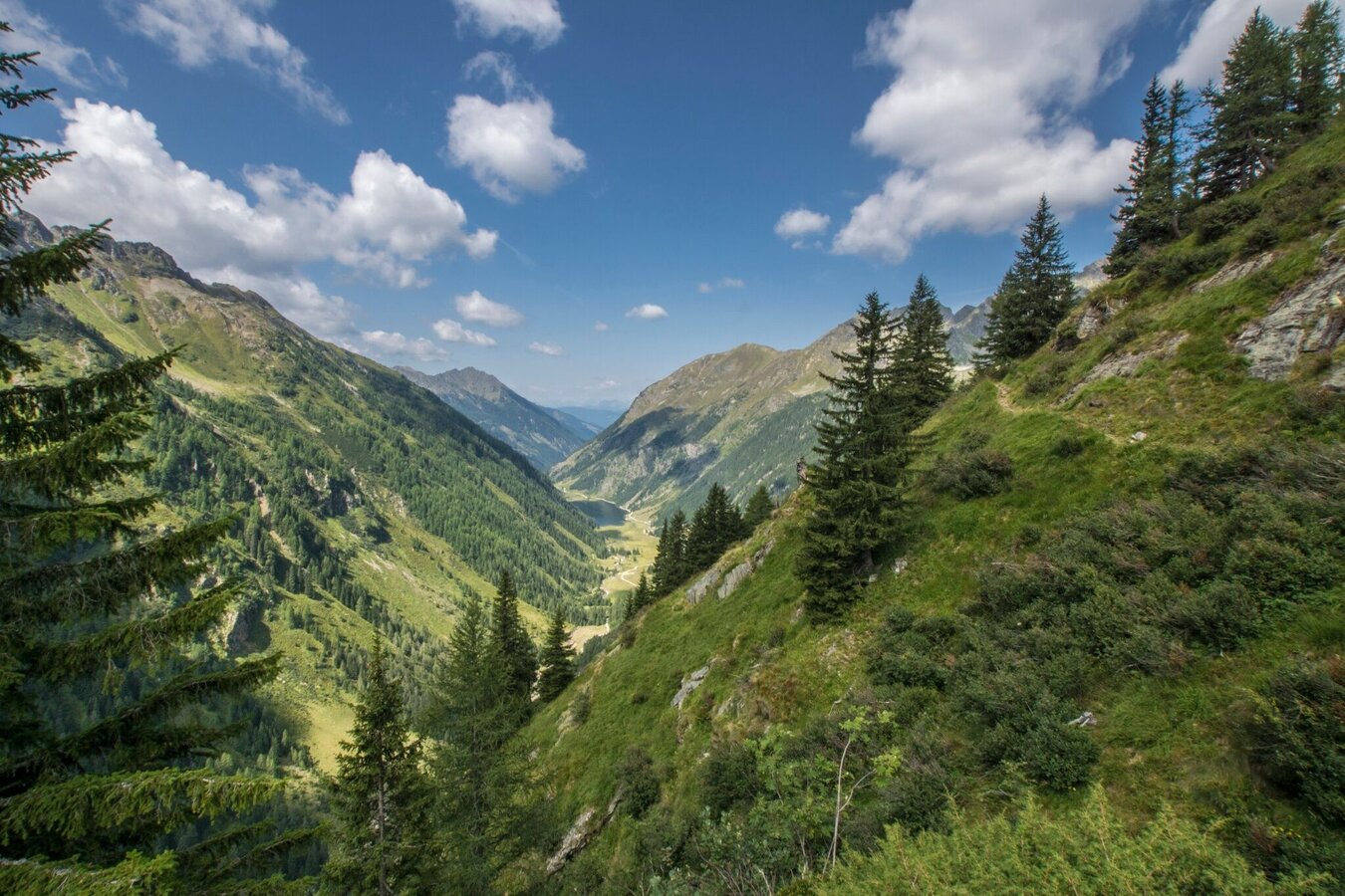
Klafferkessel lake plateau is abounding in water and core of Wild Waters Untertal in Rohrmoos. Passing by several lakes and the iconic rock formation of Greifenstein you then descend into Lämmerkare cirques via Klafferscharte ridge. Running out of the cirques you reach Preintalerhütte and Waldhornalm (1,656 m) mountain refuges.
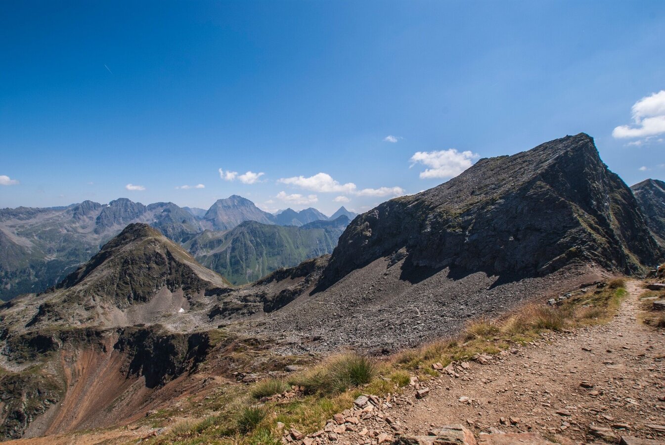
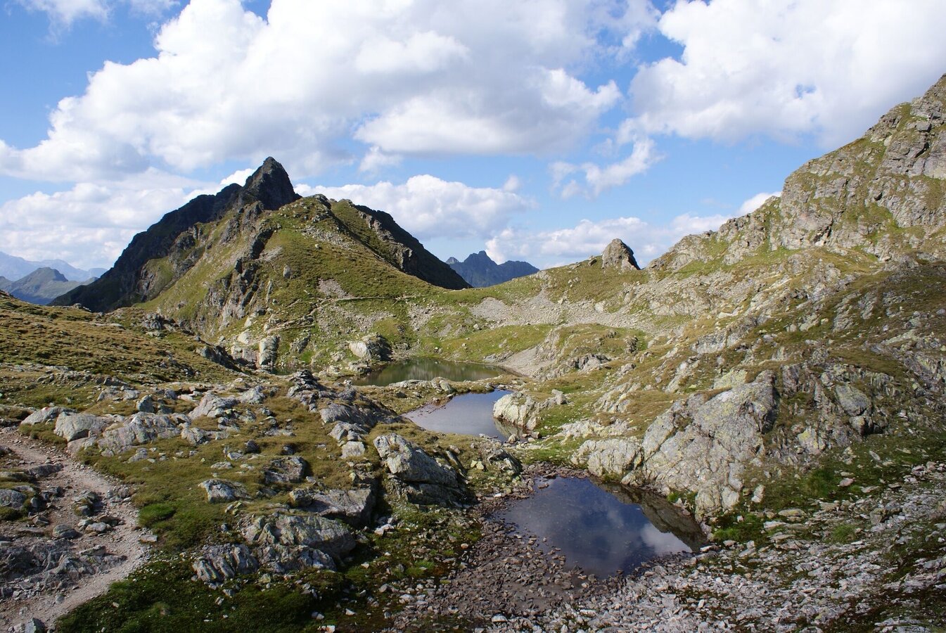
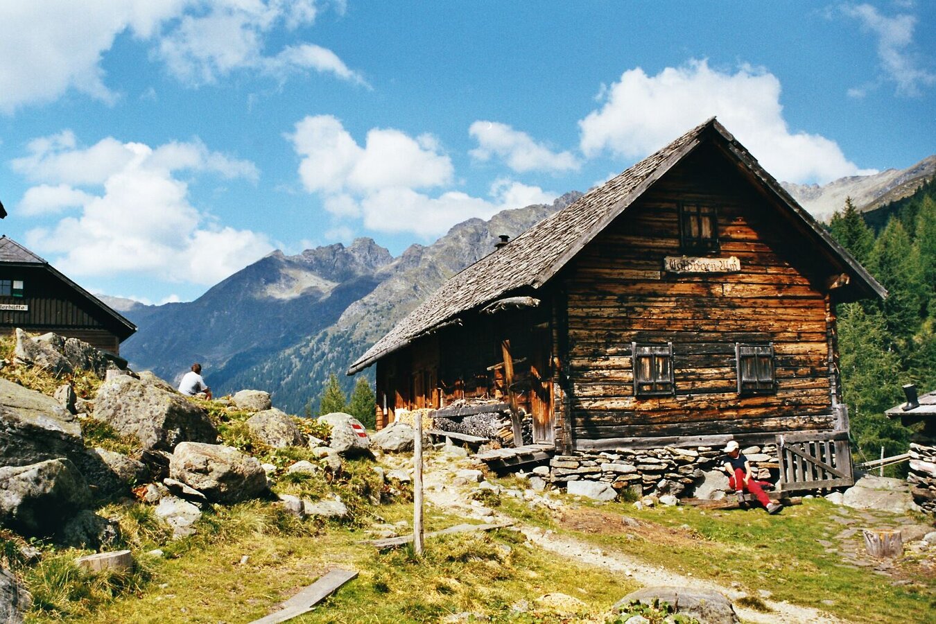
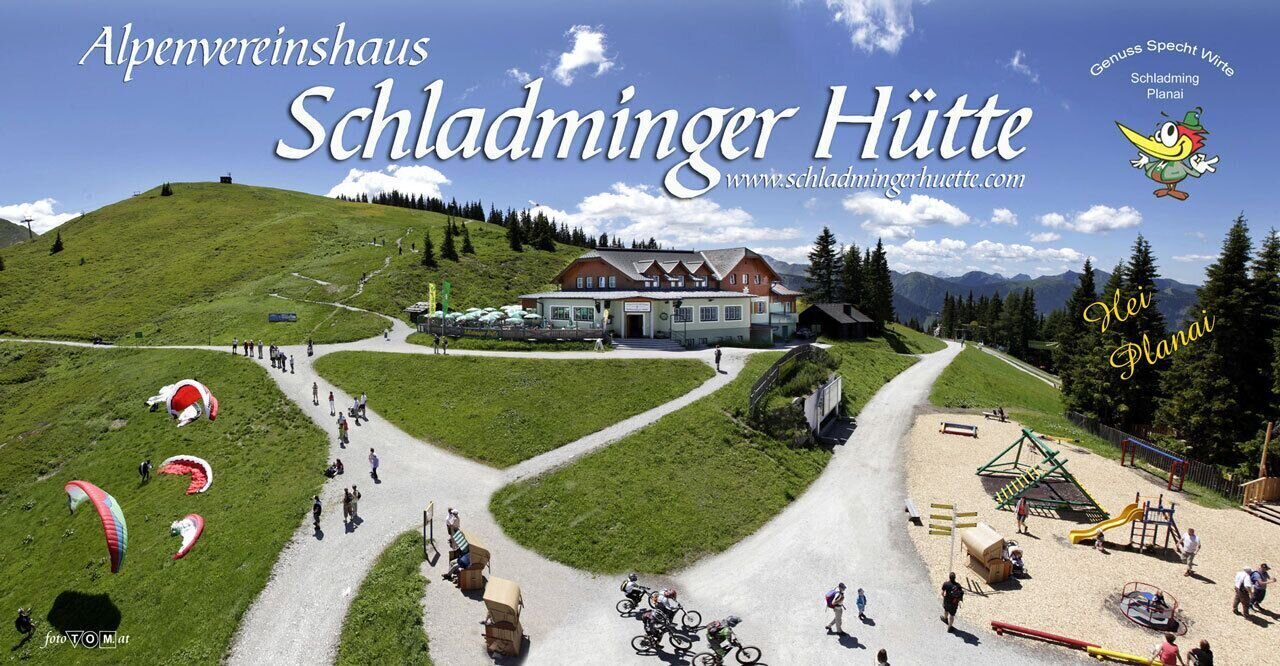
Make a right at the huts and then a left, crossing over the creek onto »Höfertsteig« trail, which takes you to Neualm – a privat mountain hut. There, follow trail #781 towards Planai. Passing by the trail intersection Kaltenbach (at 2,040 m) and running below the summits of Ulmspitze, Hasenkarspitze, Sonntagerhöhe, Seerieszinken and Krahbergzinken you finally reach Planai and Schladminger Hütte (1,828 m).
From Schladminger Hütte you take the cable-car down to Schladming. Alternatively you can run down World Cup Trail Planai or hiking trails #779/#53 (about 1,080 meters in vertical descent).
With the Planai buses from Schladming (Planet-Planai, Lendplatz) or Rohrmoos (Rohrmoos-Zentrum) to the valley terminal of the Hochwurzen cable-car - bus stop "Gipfelbahn Hochwurzen".
- Buses of Planai-Hochwurzen-Bahnen: www.planaibus.at
From there take the Hochwurzen cable-car to Hochwurzenhütte on top of Hochwurzen - alternatively run Hochwurzen Trail (running trail n° 6 - same route as hiking trail # 60) .
- Operating times of the cable-car: www.planai.at
Schladminger Tauern Trail is an exposed single track in high-alpine exposed terrain with significant gains. At a distance of over 40 km it is only for runners in good physical condition with alpine experience. Appropriate equipment as well as good tour planning are indispensable.
Changes in weather patterns, quick falls in temperature, thunderstorms, wind, fog and snow are some of the dangers that can be encountered on a route in high alpine terrain. Hosts of alpine huts and mountain refuges have a lot of experience in the mountains and can give good advice about weather and the trails. Poor equipment, overestimation of one's own capabilities, carelessness, poor personal constitution and/or wrong judgement can lead to critical situations. In case of thunderstorms: avoid summits, ridges and steel ropes.
GPS data and orienteering
Available GPS data - just like hiking maps - is only a guidance for orientation and can never depict a trail exactly with all its details. Especially at dangerous spots it is essential to judge on site how to proceed.
In an emergency please call:
- 140 - for Alpine emergencies (all over Austria)
- 112 - European GSM emergency number
Very good trailrunning shoes required. Moreover, on this route, you should bring along at least the following basic equipment:
- backpack
- hydration bladder
- first-aid kit
- GPS
- energy bars
- rainwear
This trail run is also possible in 2 stages. For that we recommend an overnight stay at Keinprechthütte, Gollinghütte or Preintalerhütte mountain refuges.
360° drone images
Get yourself an overview with our 360° drone images:
- Hochwurzen, Rossfeld & Guschen: https://vonoben.schladming-dachstein.at/sommer/index.php?S=305
- Hochfeld and Schiedeck: https://vonoben.schladming-dachstein.at/sommer/index.php?S=306
- View over Giglachkar cirque: https://vonoben.schladming-dachstein.at/sommer/index.php?S=307
- Giglachseen and Kalkspitzen summits: https://vonoben.schladming-dachstein.at/sommer/index.php?S=308
- Lower Giglachsee Lake and Vetternkar cirque: https://vonoben.schladming-dachstein.at/sommer/index.php?S=309
- Via Rotmandlspitze: https://vonoben.schladming-dachstein.at/sommer/index.php?S=310
- View into Neualmkar cirque: https://vonoben.schladming-dachstein.at/sommer/index.php?S=312
- At Trockenbrotscharte ridge: https://vonoben.schladming-dachstein.at/sommer/index.php?S=313
- Landawirseen Lakes: https://vonoben.schladming-dachstein.at/sommer/index.php?S=314
- View over Klafferkessel: https://vonoben.schladming-dachstein.at/sommer/index.php?S=315
- View into Lämmerkare cirques: https://vonoben.schladming-dachstein.at/sommer/index.php?S=316
- Descent from Preintalerhütte: https://vonoben.schladming-dachstein.at/sommer/index.php?S=317
- View over Riesachsee Lake: https://vonoben.schladming-dachstein.at/sommer/index.php?S=318
- The trail near Rabenköpfl: https://vonoben.schladming-dachstein.at/sommer/index.php?S=327
- The trail between Seerieszinken and Krahbergzinken: https://vonoben.schladming-dachstein.at/sommer/index.php?S=328
Further helpful links
Tourist information: www.schladming.com
Information about bus schedules: www.planaibus.at
Information about cable-car hours: www.planai.at
- Tourist map "Hiking - Running - Walking", available at the tourist office Schladming.
-
Hiking map Schladming, 1:25.000, available at the tourist office Schladming.
- Guide book Schladming-Dachstein by Herbert Raffalt, available at the tourist office Schladming.


