Route 66 | 66
Tour description
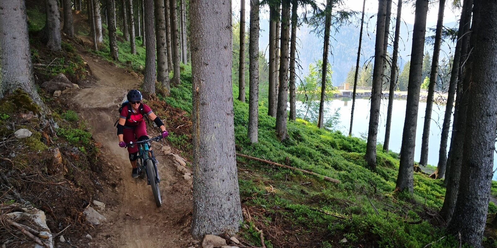
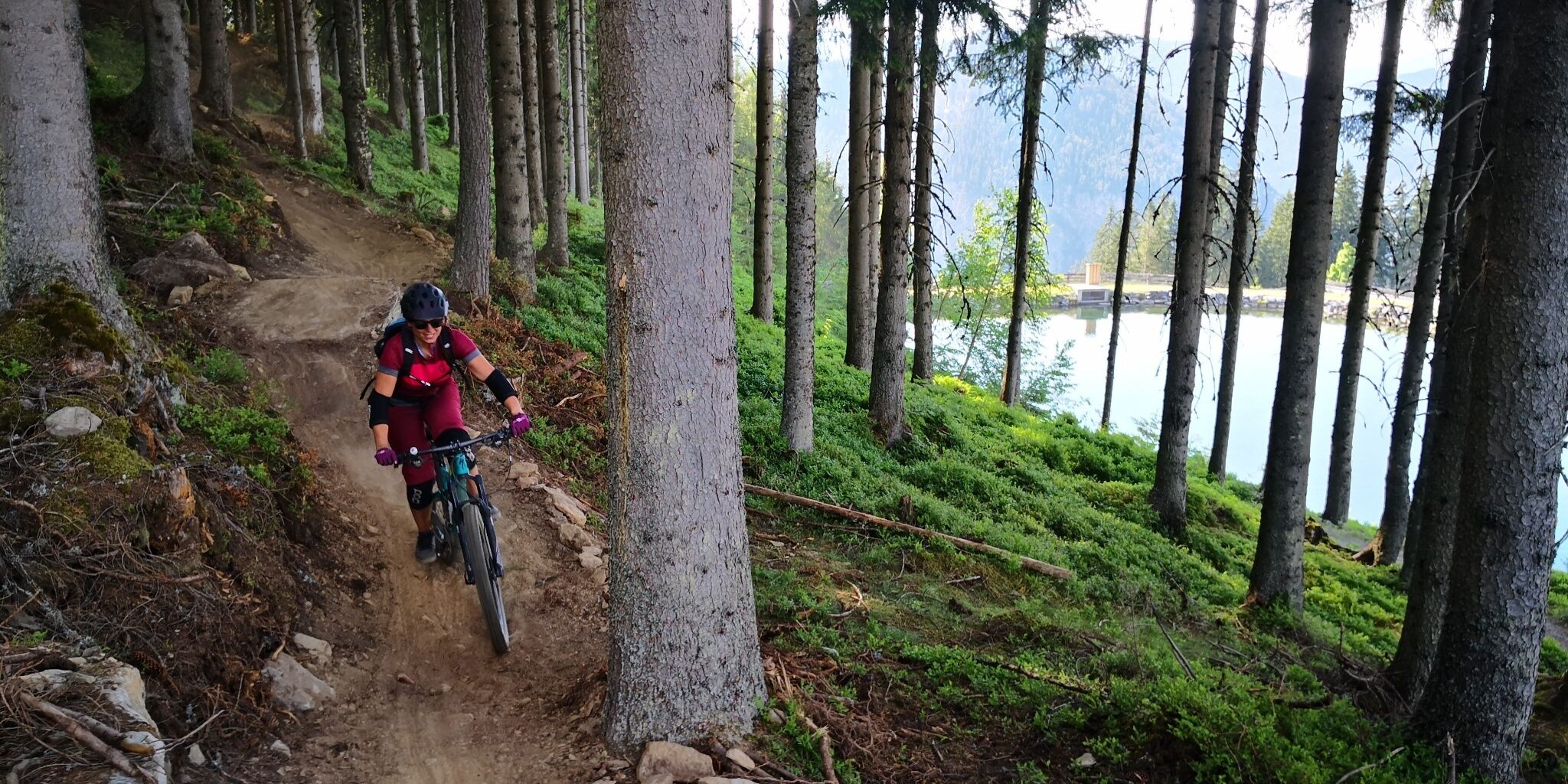
The "Route 66", named after the old hiking trail number, is a flowing forest trail with soft, needle-covered ground. After a short forest path passage, a newly built and narrow trail section begins, with tighter bends.
Opening hours 2025 Preunegg Jet gondola:
Pre-season (08:45 to 17:00)
June 6 - June 22: Friday to Sunday and public holidays
High season (08:45 to 17:00)
June 27 - September 7: daily
Low season (08:45 to 17:00)
September 12 to October 20: Friday to Monday
October 24 to November 02: daily
The tour
Map, elevation profile & further information
After approx. 500m on the Schnepfenwald Trail, Route 66 branches off directly to the left and leads along an old hiking trail to a forest path, on which you have to cycle uphill for a short distance, then Route 66 branches off to the left into a fast, varied second section. The trail ends directly at the Schnepfenalm. After a short stretch on the road, you reach the final section of the Schnepfenwald Trail, which leads directly to the Preunegg Jet valley station.
From Salzburg:
Follow the A10 to Altenmarkt. There join the B320 and continue in the direction of Liezen. At the Pichl/Preunegg exit, follow the Preunegg road for approx. 3.5km.
From Graz:
Follow the A9 until Liezen. There join the B320 and continue in the direction of Schladming. At the Pichl/Preunegg exit, follow the Preunegg road for approx. 3.5 km.
Valley Station Preunegg Jet:
Preunegg 70, 8973 Schladming
There are plenty of parking spaces at the Preunegg Jet valley station available!Bike- and hiking bus
from Schladming via Rohrmoos to the Preunegg Jet-Reiteralm
Stop for bikers:
- Schladming - Planet Planai
- Schladming - Lendplatz
- Rohrmoos-Dorf (traffic circle)
- Talstation Gipfelbahn Hochwurzen
- Reiteralm - Preunegg Jet
Code of honor:
- It is recommended that you first inspect the route at moderate speed to familiarise yourself with the route and any obstacles.
- Only drive on paved and signposted paths.
- The safety distances to the driver in front must be observed.
- Pay attention to traffic at crossroads! Be considerate and give way.
- Avoid blocking the back wheel and thus help to maintain the paths.
- Control your speed!
- Protect the environment and don't leave garbage, etc. in the mountains!
Recommendation on all routes of the Reiteralm Trails:
- suitable mountain bike
- helm
- good footwear
- obligatory elbow and knee pads


