Grimming-Donnersbachtal
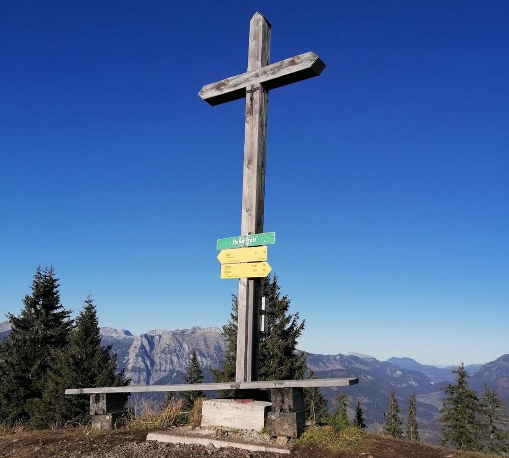
Hohe Trett
Hiking trail
Data:
Tour description
You can go an other way up and town.
The tour
moderate
Starting point
Parking under Möslhof
Destination
Parking under Möselhof
Tour characteristics
Fitness (3/6)
Skills (2/6)
Information
Distance: 11.45 km
Duration:
4 h
Ascent: 623 m
Descent: 623 m
highest point: 1681 m
Best season
Jan
Feb
Mar
Apr
May
Jun
Jul
Aug
Sep
Oct
Nov
Dec
Map, elevation profile & further information
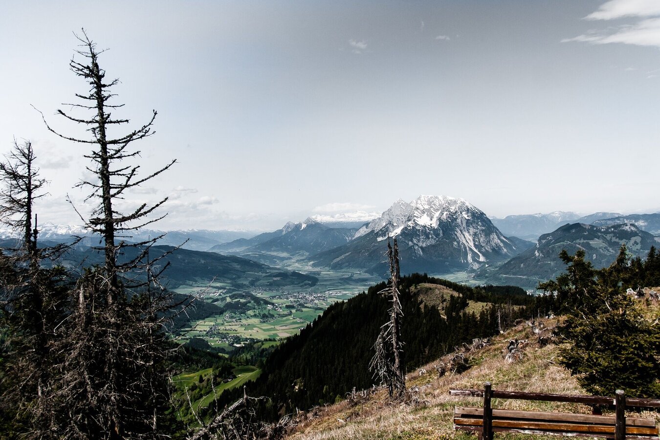
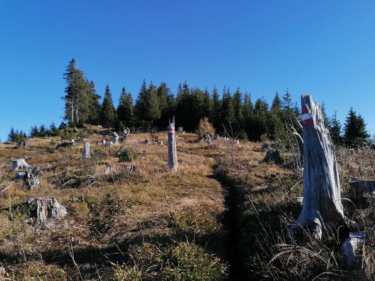
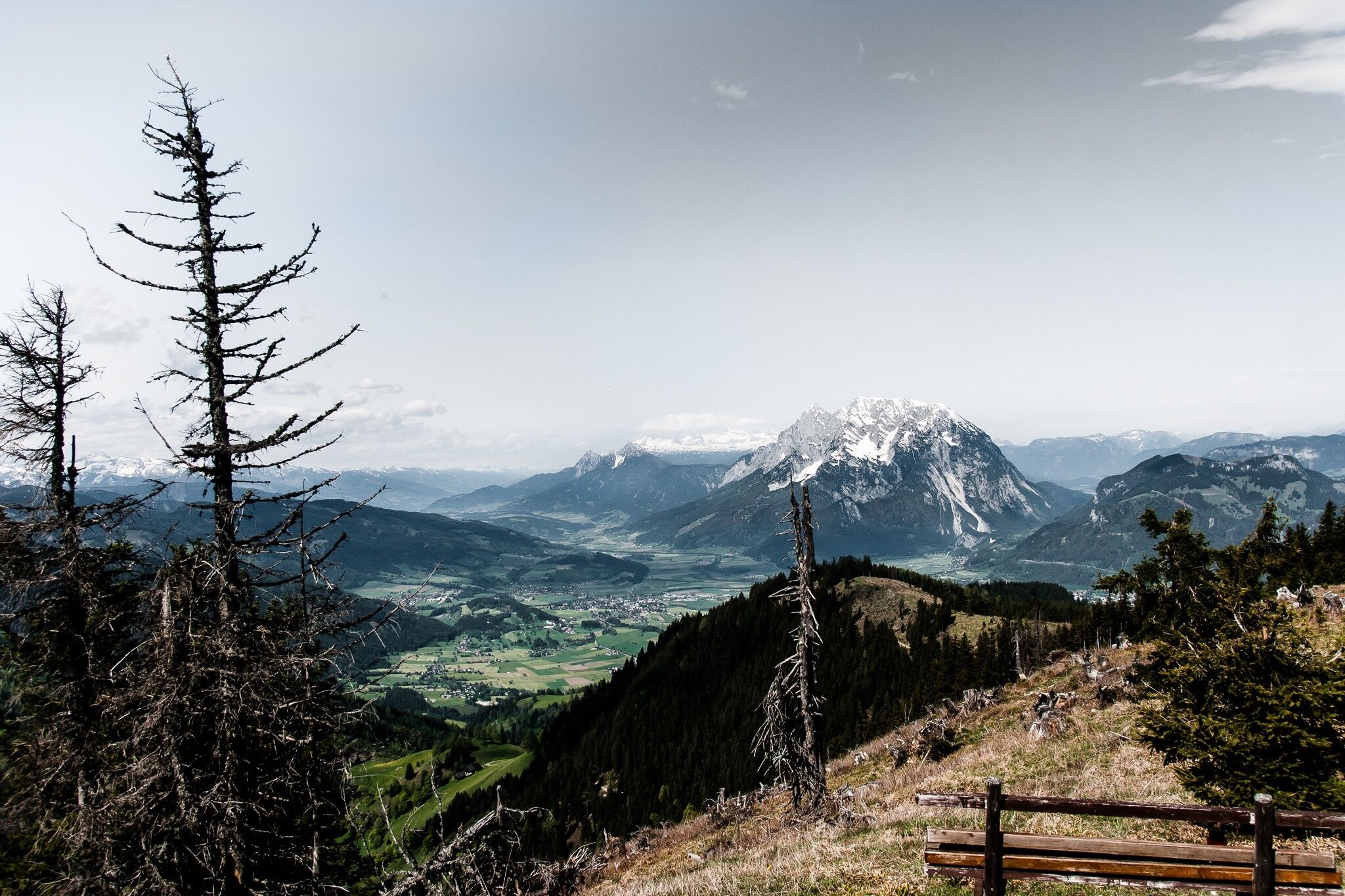
A hike high above Aigen with magnificent views - Grimming, Ausseerland, Dachstein and Gesäuse - all within reach. Starting from the parking lot, you initially walk along the asphalt road to the "Möslhof" and continue to the signposts. Following the signposts, you now hike somewhat steeper via Kohlanger on forest and woodland paths up to the Hohe Trett, not the highest but the highest summit cross in the region. Snack and grab 1A mountains, before you march back downhill and over the Schwoagalehen to the starting point.
Leave the Ennstal highway (B320) in Wörschach or Trautenfels and continue to Aigen im Ennstal. In the district "Ketten" turn off in the direction of Ritzmannsdorf or Vorberg. Follow the road uphill and then turn left at Vorberg to Möslhof.Parking before the farm Möslhof
- Plan your tour in advance, taking into account walking time, route length, altitude difference, danger spots and weather forecast.Together is much more beautiful and at the same time safer in the mountains.
- Do not go alone, if possible, and adapt the tour to the ability of your group.
- Let them know where you are going and when you want to be back. Also sign hut or summit books.
- Turn back in good time if the weather deteriorates. If you get caught in a thunderstorm, do not stay on the summit or ridge and stay away from individual trees. Wait out the storm, if possible in a crouching position.
- Stay on the marked trails and remember to close pasture fences again.
- Getting up the trail is only half the battle. Stay alert, especially on the descents, to make it back to the valley safely.In case of emergency, keep calm and call the mountain rescue on 140. If you have no reception, take out the sim card and dial 112.
- If you encounter cows: It is best to pass above the herd with at least 50 meters distance. Stay calm, don't make any frantic movements and don't run away. Do not imitate cow sounds and do not try to pet the animals. A stick and loud shouting can often make the animals turn back in an emergency.
- If you are a dog owner: Clarify before the hike if you have to cross a pasture. Keep your dog on a leash and make sure he stays calm. If a cow attacks, let the dog off the leash immediately. Never pick him up to defend him.
- You can get detailed information on "Safe Mountain Hiking" from the Alpine Club. At www.alpenverein.at you can inform yourself comprehensively about it.
A short visit to the Nature.power.place. Stalingradkapelle makes it perfect.
Tourism information: www.schladming-dachstein.at
Tourist Office Schladming-Dachstein
Ramsauerstrasse 756
8970 Schladming
T: +43 3687 23310
info@schladming-dachstein.at
Garbage on meadows and paths can not smell mountain and valley. Please take it with you. Agriculture and forestry are important partners for Berg und Tal. They allow you to walk and drive on many of their paths. Be aware that only good cooperation will guarantee your recreational enjoyment in the future.
- SCHLADMING-DACHSTEIN Hiking EAST. Available free of charge from the information offices in the region.
- SCHLADMING-DACHSTEIN Hiking Map (1:50.000)
- KOMPASS Hiking Map 68, Ausseerland-Ennstal 1:50.000, hiking, biking, ski touring


