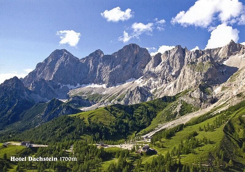
Ramsau am Dachstein
Hike to the Südwandhütte
Hiking trail
Data:

Tour description
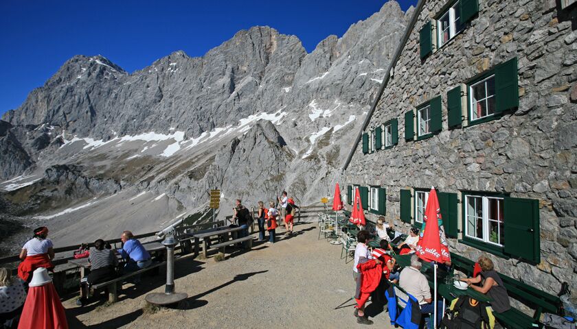
The trail to the Südwandhütte is a high alpine hike at the foot of the imposing Dachstein south walls. The trail is wonderfully situated on the sunny side of the mountain, making the hike a pleasure until late autumn. The Dachstein Südwandhütte itself is located at 1,910 m above sea level, in the high alpine pasture area of Ramsau. The hut is staffed (self-service) and offers traditional hut dishes. Here you can enjoy the magnificent panorama from the spacious terrace to the imposing Dachstein massif and the Schladminger and Radstädter Tauern mountains.
The tour
moderate
tour.detail.accessible-by-public-transport
Starting and end point
Berghotel Türlwand
Tour characteristics
Fitness (3/6)
Skills (4/6)
Information
Distance: 3.14 km
Duration:
1 h 15 min
Ascent: 220 m
Descent: 220 m
highest point: 1910 m
Best season
Jan
Feb
Mar
Apr
May
Jun
Jul
Aug
Sep
Oct
Nov
Dec
Map, elevation profile & further information
The hike begins at the car park of the Dachstein Gletscherbahn valley station. The trail begins to the right of the valley station building. At first, trail no. 615 leads gently uphill along the slope below the cablecar ropes. Later it makes a generous left curve and leads at the foot of the "Zughalswand" with a magnificent view of the mountain world of the Niedere and Hohe Tauern to the Südwandhütte.
Take bus line 960 to the Dachstein/Türlwandhütte stop. You can find all lines and timetables here.
In spring there may still be snow on the path. Good hiking equipment, sturdy shoes, hiking poles
The Südwandhütte is the starting point for hikes, via ferratas and climbing routes.
Click here for the homepage of the Südwandhütte
Hiking map Schladming-Dachstein, 1:50,000, available in the information offices
Hiking guide Schladming-Dachstein by Herbert Raffalt (available only in German), available in the information offices


