Haus-Aich-Gössenberg
Hike to the Hans-Wödl-Hütte
Mountain tour
Data:
Tour description
The tour
moderate
tour.detail.accessible-by-public-transport
Starting and end point
Parking area Steirischer Bodensee, Seewigtal
Tour characteristics
Fitness (3/6)
Skills (2/6)
Information
Distance: 5.9 km
Duration:
2 h 50 min
Ascent: 390 m
Descent: 390 m
highest point: 1533 m
Best season
Jan
Feb
Mar
Apr
May
Jun
Jul
Aug
Sep
Oct
Nov
Dec
Map, elevation profile & further information
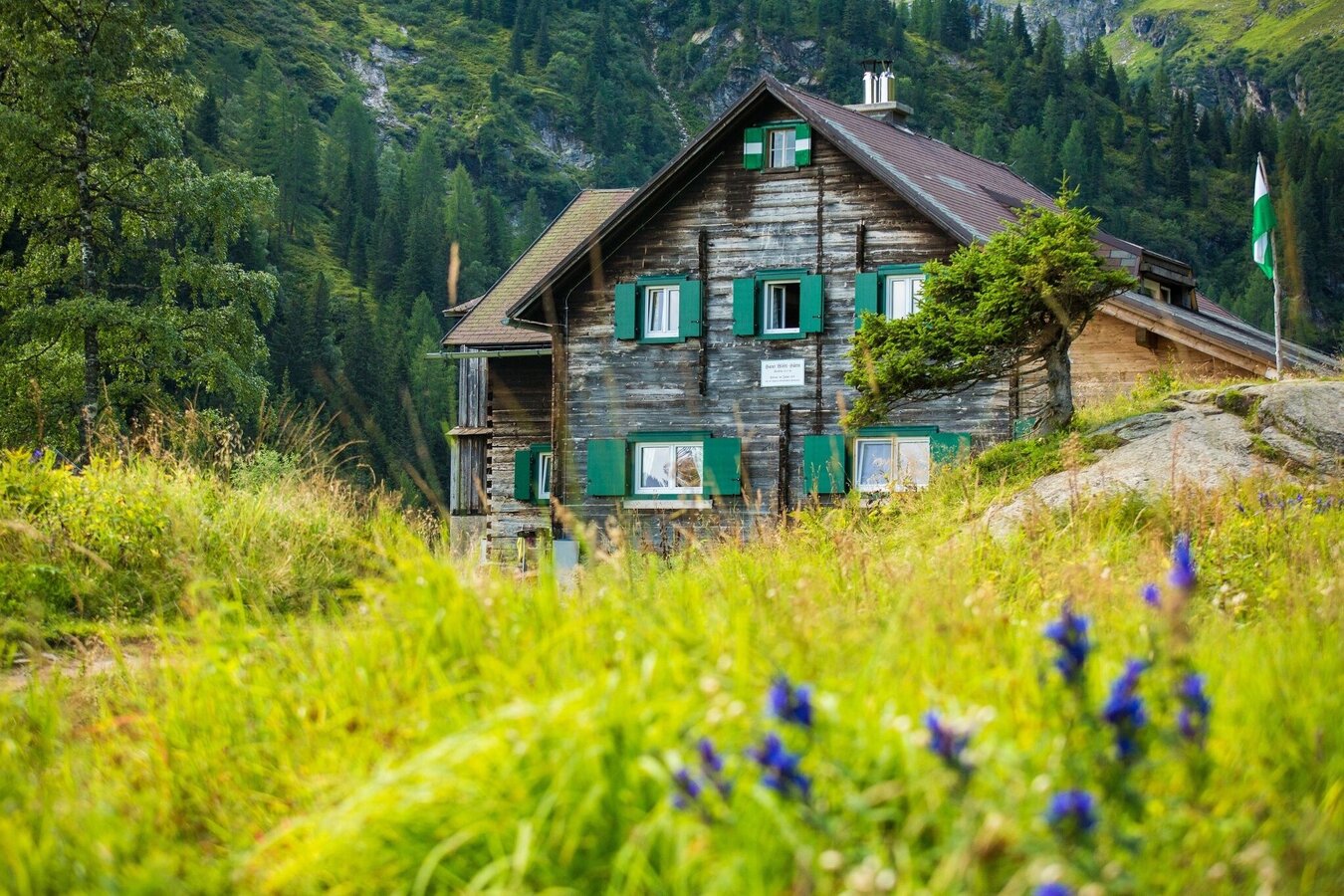
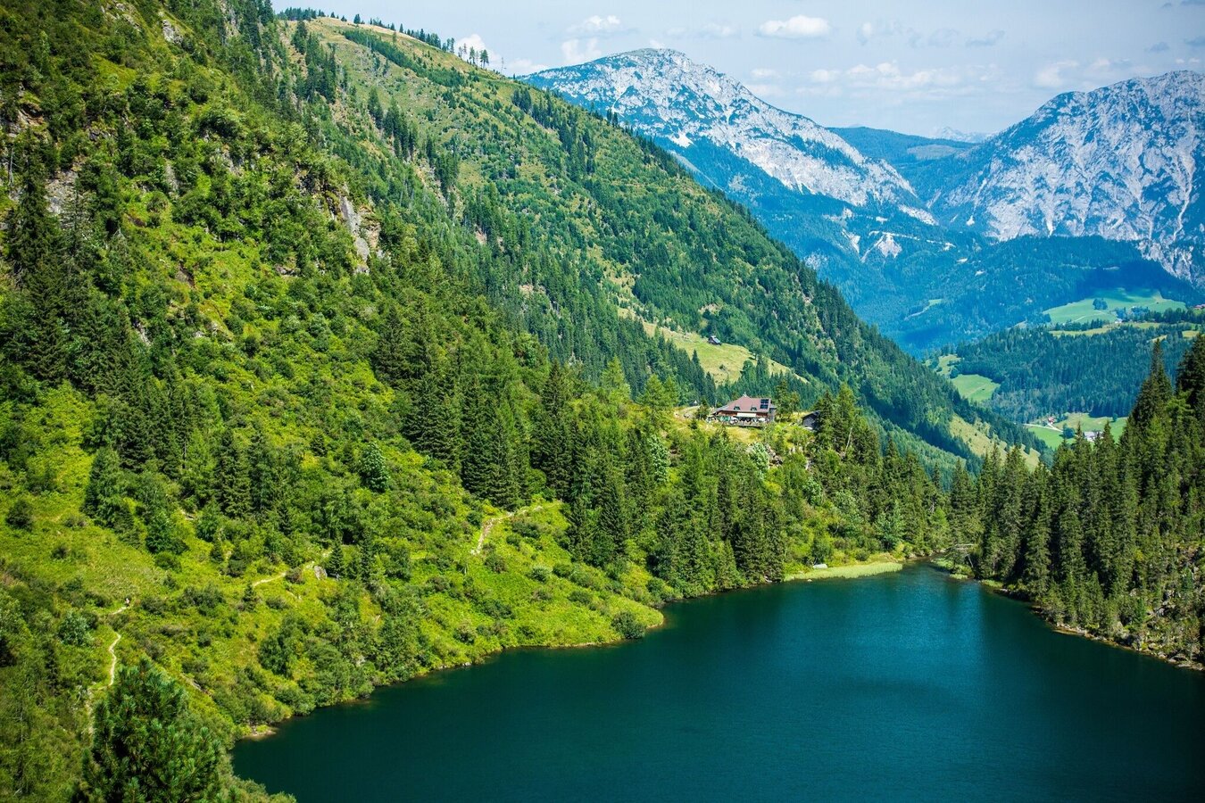
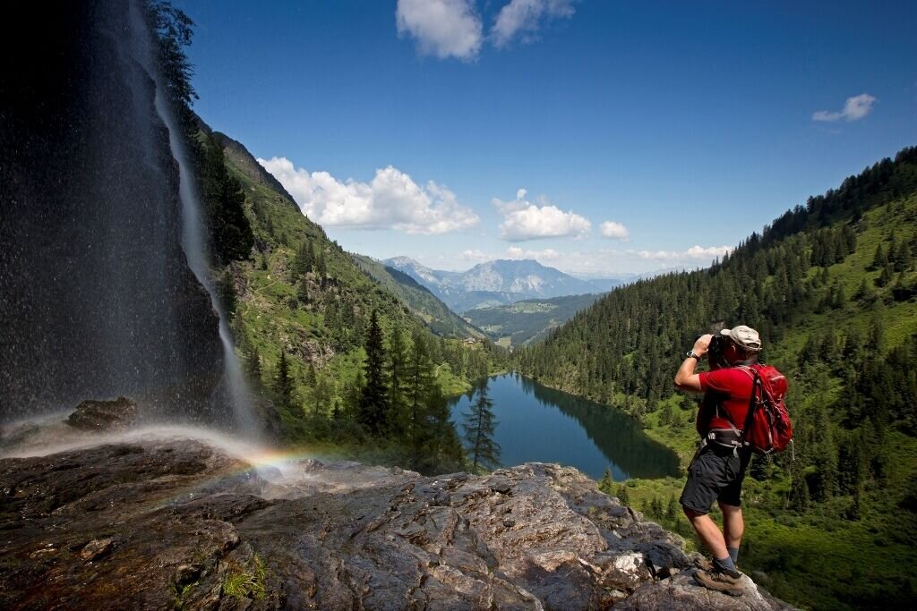
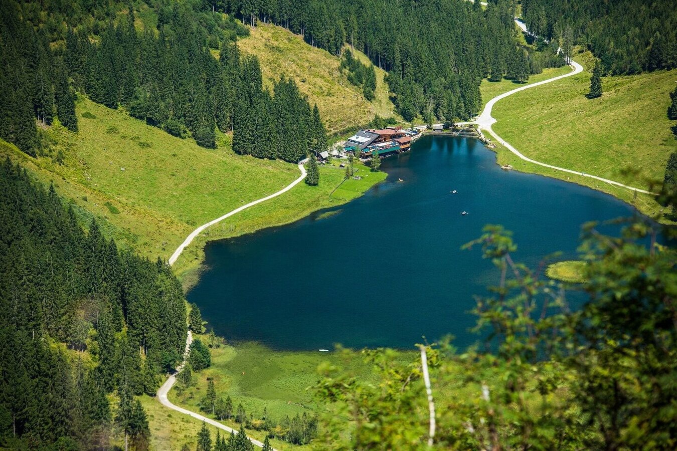
Via Ruperting near Haus im Ennstal or Aich/Gössenberg, we reach the parking lot in the Seewigtal valley via a toll road. We walk for about 15 minutes on a wide path along the stream to the Steirischer Bodensee. Once at the end of the lake, the trail continues via the ascent with the number 782, which leads over a waterfall to the Hans-Wödl-Hütte at the Hüttensee. The hut is about 1 hour's walk above the Steirischer Bodensee and is therefore an ideal destination for a day trip. After the hike, we can enjoy the view of the Hüttensee and the Hochwildstelle from the terrace and fortify ourselves with the farm's own delicacies of beef, pork and brook trout. The hut is also a great starting point for crossings and high alpine tours. The way back is via the same route and from the Steirischer Bodensee/Seewigtal parking lot you can take the 976 Steirischer Bodensee bus back through Weißenbach bei Haus to Haus im Ennstal or to Schladming.
Ennstalbundesstraße (B320) - exit: Ruperting (near Haus im Ennstal) or Gössenberg - follow the respective toll road into the Seewigtal valley.
parking area Steirischer Bodensee/Seewigtal
parking area Steirischer Bodensee/Seewigtal
between the end of May and mid-October: Planaibus (line: Schladming - Haus - Steirischer Bodensee)
otherwise no arrival by public transport possible.
Sure-footedness and a head for heights are required! High mountain boots with profiled soles, backpack with rain protection, plenty of non-alcoholic drinks, snacks, fruit, medicines (which need to be taken during the day), sun protection (sunscreen, sunglasses, possibly a cap), a change of clothes, camera, hiking poles are recommended
Tour at your own risk! No liability is assumed for any given or occurring alpine dangers (weather, etc..). Schladming-Dachstein hiking map


