Guttenberghaus - Ramsau-Ort | Sun Trail Dachstein: Stage 03

Tour description
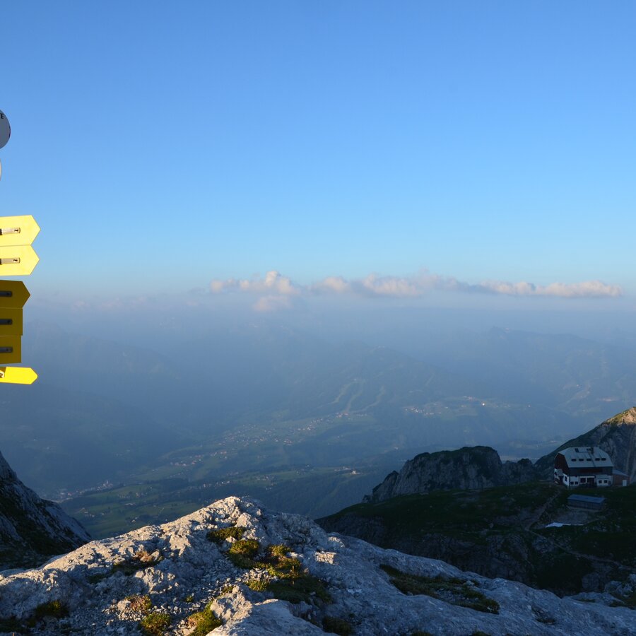
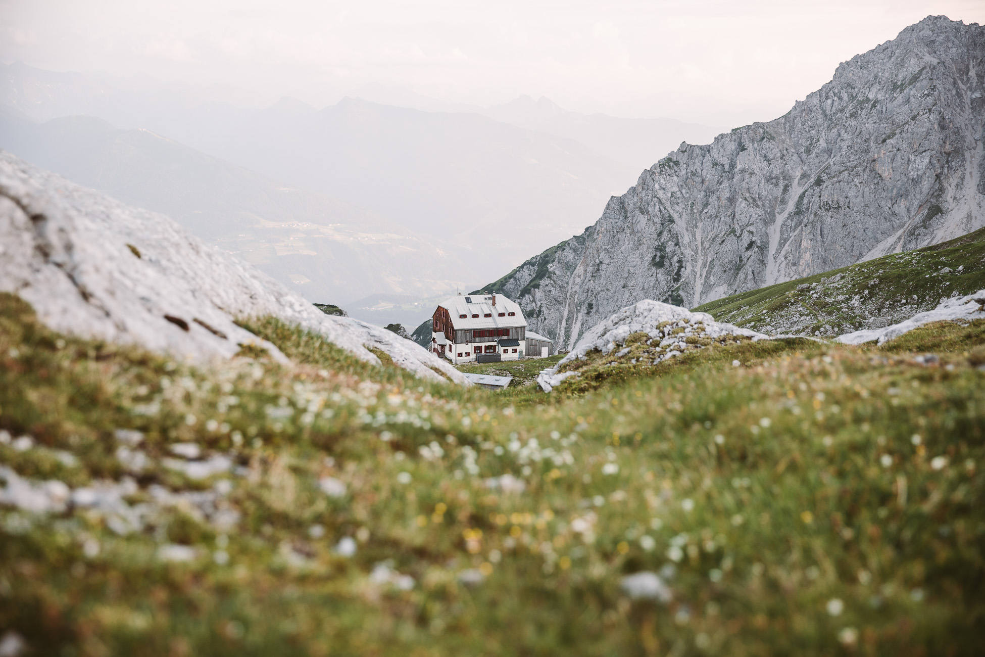
From the highest mountain hut in Styria, the Guttenberghaus, it goes on the "Königsetappe" and through the Silberkar to Ramsau and over the plateau to Ramsau Ort. On the way there are attractive "secondary destinations" such as the summit of the Sinabell, the Silberkarsee or the Silberkarklamm, which easily add 1 to 2 hours to the normal walking time of around 4.5 hours, but are definitely worth the "detour".
The tour
Map, elevation profile & further information
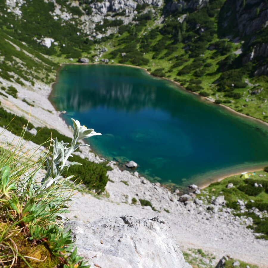
After spending the night in the Guttenberghaus, a beautiful high-altitude hike awaits you with an attractive view down to Ramsau and the Schladminger Tauern. From the Feistererscharte, path #618 first leads east on the north slope of the Sinabell as a pleasant climb. After a good hour's walk, coarse boulders and the wild landscape above the Hölltal dominate. A surprising sight is the Hölltalsee, far below, with its emerald green sea eye. A narrow path leads down to the lake.
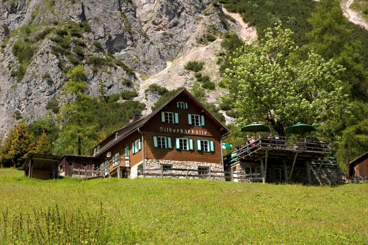
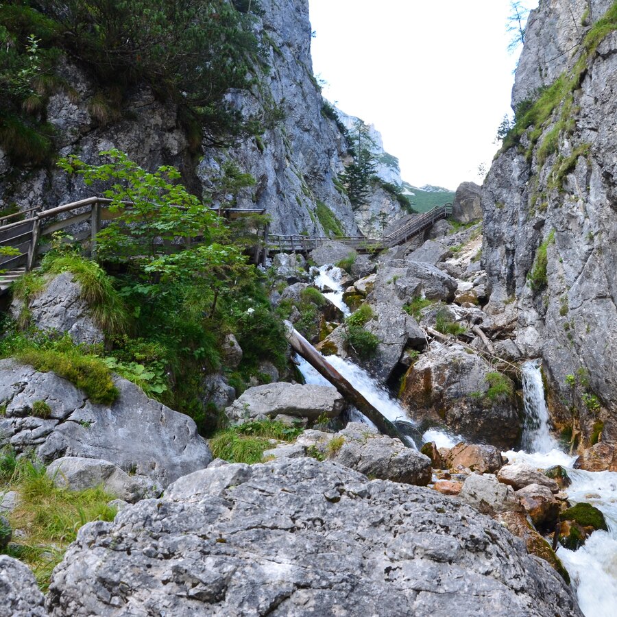
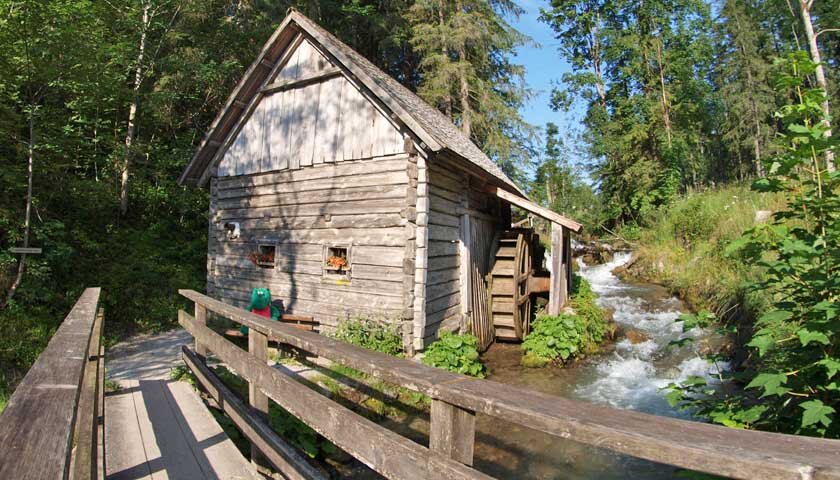
Continue on path #619. After the Grubach, the path branches off and leads steeply and stony downhill in serpentines via the Stangalm to the Silberkarhütte. The hut at 1,223 m above sea level offers you rich organic products from its own organic farm. The rest of the way is different again and entertaining. It goes through the romantic wild water gorge past the Schleier waterfall, over stairs and footbridges down the rushing brook to the lower exit of the Silberkarklamm. Here you now follow the signs in the direction of Ramsau-Ort. Past the fly mushroom snack bar you reach the old mill in Ramsau Rössing. From there you have two options for getting to Ramsau-Ort or your car:
- either above the state road - past the Hotel Feisterer to Ramsau-Ort and via the Philosophenweg to Ramsau-Kulm or
- along the Hofrat-Gruber-Weg to Ramsau Kulm (to the car) and/or further on the Philosophenweg to Ramsau-Ort.
Alternatively, you can also take the bus from the Silberkarklamm or Alte Mühle car park to Ramsau-Ort.
Variant Austriahütte: From Ramsau Ort to the starting point of the hike, Edelbrunn and via the Roseggersteig to the Brandriedel, where the magnificent panoramic view of the Dachstein south walls awaits you again. A wide forest path, past Austriahütte, Brandalm and Dachsteinhaus, leads you back to WA Edelbrunn and to Ramsau-Ort.
From west:
Tauernautobahn A 10 to the Ennstal junction - exit in the direction of Graz/Schladming - about 20 km on the Ennstal federal road to Schladming. Turn off in Schladming Mitte and follow the state road in the direction of Ramsau am Dachstein.
From the north:
Pyhrnautobahn in the direction of Liezen Ennstalbundesstraße to Schladming. Turn off in Schladming Mitte and follow the state road in the direction of Ramsau am Dachstein.
The tour begins at the Guttenberghaus, which you can reach either via the previous stage from the Dachstein glacier, or via a direct ascent from the Hotel Feisterer in Ramsau.
Feisterer/Guttenberghaus car park below Hotel Feisterer.
You can take the Ramsauer Verkehrsbetriebe bus from Schladming train station to Ramsau or to the Dachstein Gletscherbahn.
- Ramsau hiking bus timetable at www.rvb.at
The tour begins at the Guttenberghaus, which you can reach either via the previous stage from the Dachstein glacier, or via a direct ascent from the Hotel Feisterer in Ramsau.
High alpine tour!
Changes in weather patterns, quick falls in temperature, thunderstorms, wind, fog and snow are some of the dangers that can be encountered on a hiking tour. Hosts of alpine huts and mountain refuges have a lot of experience in the mountains and can give good advice about weather and the trails. Poor equipment, overestimation of one's own capabilities, carelessness, poor personal constitution and/or wrong judgement can lead to critical situations. In case of thunderstorms: avoid summits, ridges and steel ropes.
GPS data and orienteering
Available GPS data - just like hiking maps - is only a guidance for orientation and can never depict a trail exactly with all its details. Especially at dangerous spots it is essential to judge on site how to proceed.
In an emergency please call:
- 140 - for Alpine emergencies (all over Austria)
- 112 - European GSM emergency number
A well-packed backpack is helpful and especially when touring Alpine terrain a tuque, gloves, a windproof jacket and pants are standard equipment. Good, waterproof shoes, sun glasses, sun cream and sufficient beverages are essential too. Torch light, a map of the area, knie and a small first-aid kit should also be in the backpack.
A detour to the Silberkarsee is worthwhile.
Leisure map "WEST" for the Schladming-Dachstein region, available from the information offices in the Schladming-Dachstein region.
