Ramsau am Dachstein
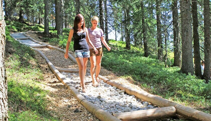
Barefoot on the Rittisberg
Hiking trail
Data:
Tour description
On this relaxing stroll, you will step on marble, bark, mulch, sand, gravel, wood, rocks, and forest ground...experiencing more than 30 textures. An exciting experience for all ages alike!
The tour
easy
tour.detail.accessible-by-public-transport
Starting and end point
Rittisstadl
Tour characteristics
Fitness (2/6)
Information
Distance: 0.18 km
Duration:
20 min
Ascent: 5 m
Descent: 5 m
highest point: 1485 m
Best season
Jan
Feb
Mar
Apr
May
Jun
Jul
Aug
Sep
Oct
Nov
Dec
Map, elevation profile & further information
From the hiking starting point “Ramsau Beach” at the valley station of the Rittisberg 4-seater chairlift, you hike for about an hour on a wide forest path (Märchenweg) through the forest to the Rittisstadl. Alternatively, in the summer months of June, July, August to mid-September, you can also take the chairlift up to the starting point.
Arriving from the west:From the west you can take the Munich-Salzburg motorway, continuing on the Tauern motorway (A 10) until the Ennstal junction. From here take the Ennstal A-road (the B 320) for around 30 km into the Schladming-Dachstein region, then take the Ramsau am Dachstein turn-off.
Arriving from the north:From the south-east take the Pyhrnautobahn motorway (A 9) to the Liezen junction and then the Ennstal A-road (B 320) into the Schladming-Dachstein region. Then take the Ramsau am Dachstein turn-off.
Parking lot RittisbergbahnSchedule of the Ramsauer Verkehrsbetriebe: www.rvb.at


